MyTopo
Sumner Michigan US Topo Map
Couldn't load pickup availability
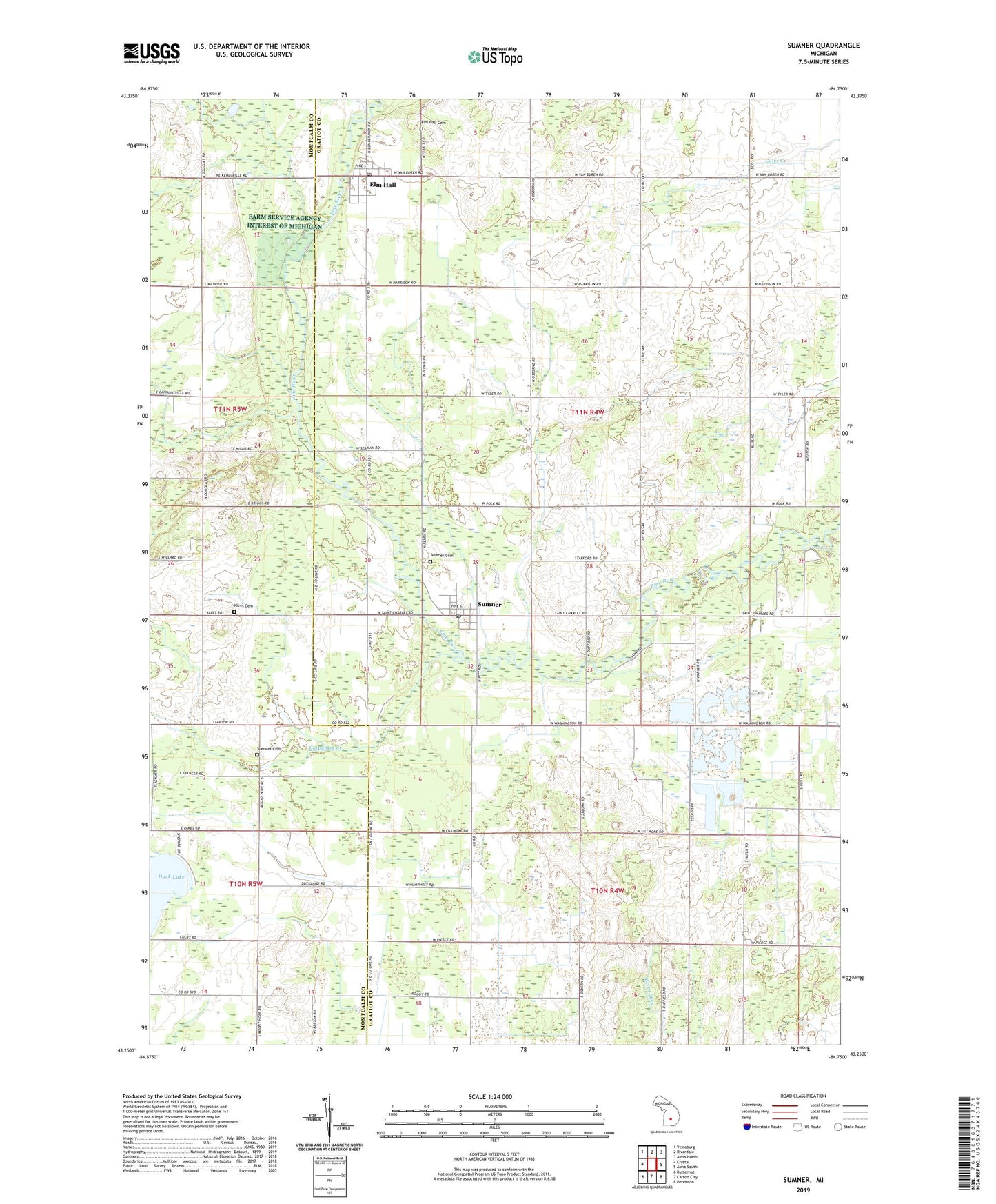
2023 topographic map quadrangle Sumner in the state of Michigan. Scale: 1:24000. Based on the newly updated USGS 7.5' US Topo map series, this map is in the following counties: Gratiot, Montcalm. The map contains contour data, water features, and other items you are used to seeing on USGS maps, but also has updated roads and other features. This is the next generation of topographic maps. Printed on high-quality waterproof paper with UV fade-resistant inks.
Quads adjacent to this one:
West: Crystal
Northwest: Vestaburg
North: Riverdale
Northeast: Alma North
East: Alma South
Southeast: Perrinton
South: Carson City
Southwest: Butternut
This map covers the same area as the classic USGS quad with code o43084c7.
Contains the following named places: Birch Run Station, Carpenter Creek, Church of the Nazarene, Elm Hall, Elm Hall Cemetery, Elm Hall Census Designated Place, Elm Hall Post Office, Klees Cemetery, Leisure Lake Family Campground, New Hope Tabernacle Church, Spencer Cemetery, Spencer Chapel, Sumner, Sumner Cemetery, Sumner Post Office, Township of Sumner, West Park, Wolford School, ZIP Code: 48889