MyTopo
De Tour Village Michigan US Topo Map
Couldn't load pickup availability
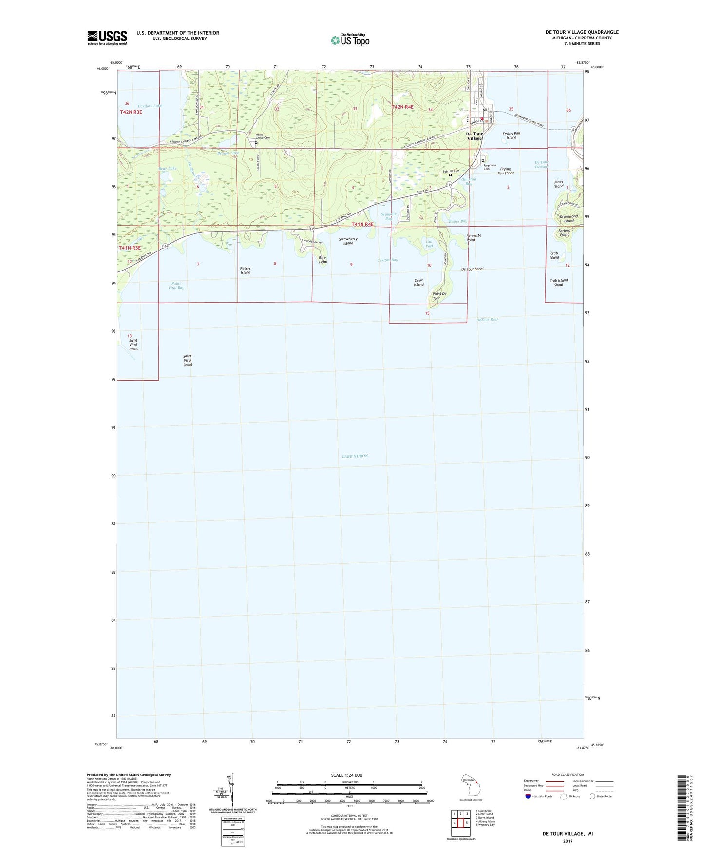
2019 topographic map quadrangle De Tour Village in the state of Michigan. Scale: 1:24000. Based on the newly updated USGS 7.5' US Topo map series, this map is in the following counties: Chippewa. The map contains contour data, water features, and other items you are used to seeing on USGS maps, but also has updated roads and other features. This is the next generation of topographic maps. Printed on high-quality waterproof paper with UV fade-resistant inks.
Quads adjacent to this one:
West: Albany Island
Northwest: Goetzville
North: Lime Island
Northeast: Burnt Island
East: Whitney Bay
Contains the following named places: Barbed Point, Bear Lake, Bennette Point, Bob Hill Cemetery, Brown Lake, Caribou Creek, Caribou Lake, Carlton Bay, Crab Island, Crab Island Shoal, Crow Island, De Tour Area Public Library, De Tour Harbor Marina, De Tour High School, De Tour Lighthouse, De Tour Passage, De Tour Passage Historical Museum, De Tour Shoal, De Tour Village, De Tour Village Medical Center, De Tour Village Post Office, DeTour Ambulance Service, DeTour Reef, Detour Village Volunteer Fire Department, Drummond Island Ferry, Dummond Dolomite Incorporated, Fort Drummond Historical Marker, Freds Marina, Frying Pan Island, Frying Pan Shoal, Gut Port, Hartley Lake, Joe Straw Creek, Jones Island, Malette Park, Maple Grove Cemetery, Olmstad Bay, Orval Lowe Memorial Park, Peters Island, Point De Tour, Redeemer Evangelical Lutheran Church, Rice Point, Riverview Cemetery, Roggs Bay, Saint Marys River, Saint Stephen's Episcopal Church, Saint Vital Bay, Saint Vital Point, Saint Vital Shoal, Seymour Bay, Strawberry Island, Village of De Tour Village, Wilderness Tabernacle Church