MyTopo
Albany Island Michigan US Topo Map
Couldn't load pickup availability
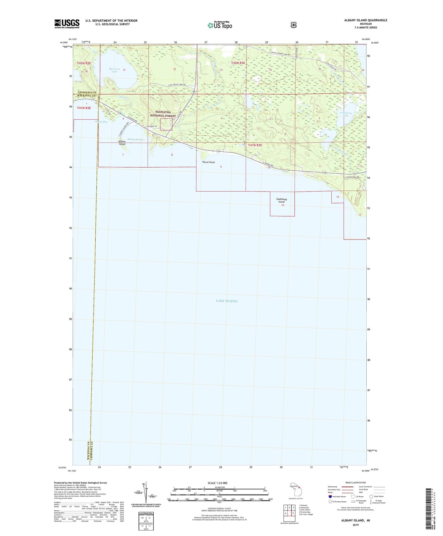
2023 topographic map quadrangle Albany Island in the state of Michigan. Scale: 1:24000. Based on the newly updated USGS 7.5' US Topo map series, this map is in the following counties: Chippewa, Mackinac. The map contains contour data, water features, and other items you are used to seeing on USGS maps, but also has updated roads and other features. This is the next generation of topographic maps. Printed on high-quality waterproof paper with UV fade-resistant inks.
Quads adjacent to this one:
West: Prentiss Bay
Northwest: Stalwart
North: Goetzville
Northeast: Lime Island
East: De Tour Village
This map covers the same area as the classic USGS quad with code o45084h1.
Contains the following named places: Albany Bay, Albany Creek, Albany Harbor, Albany Island, Big Trout Lake, Cranberry Lake, De Tour Roadside Park, De Tour State Forest Campground, De Tour State Park, Huron Point, Little Trout Lake, Saddlebag Island, Trout Creek, ZIP Code: 49725