MyTopo
Easton Michigan US Topo Map
Couldn't load pickup availability
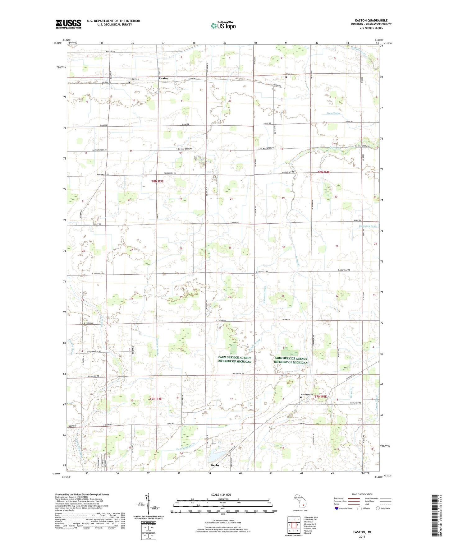
2023 topographic map quadrangle Easton in the state of Michigan. Scale: 1:24000. Based on the newly updated USGS 7.5' US Topo map series, this map is in the following counties: Shiawassee. The map contains contour data, water features, and other items you are used to seeing on USGS maps, but also has updated roads and other features. This is the next generation of topographic maps. Printed on high-quality waterproof paper with UV fade-resistant inks.
Quads adjacent to this one:
West: Owosso North
Northwest: Chesaning West
North: Chesaning East
Northeast: Montrose
East: New Lothrop
Southeast: Durand
South: Corunna
Southwest: Owosso South
This map covers the same area as the classic USGS quad with code o43084a1.
Contains the following named places: Charter Township of Caledonia, Christian Assembly Hall, Coal Mine Drain, Coon Drain, Easton, Easton Cemetery, Easton Church of Christ, Easton Post Office, Eveleth School, Galloway Drain, Kerby Road Park, Kinsman Drain, Northwest Venice Church, Rogers Drain, Saxon Drain, Stewart Drain, Township of New Haven, Vietz Cemetery, Wilkinson Cemetery, ZIP Code: 48817