MyTopo
Ellington Michigan US Topo Map
Couldn't load pickup availability
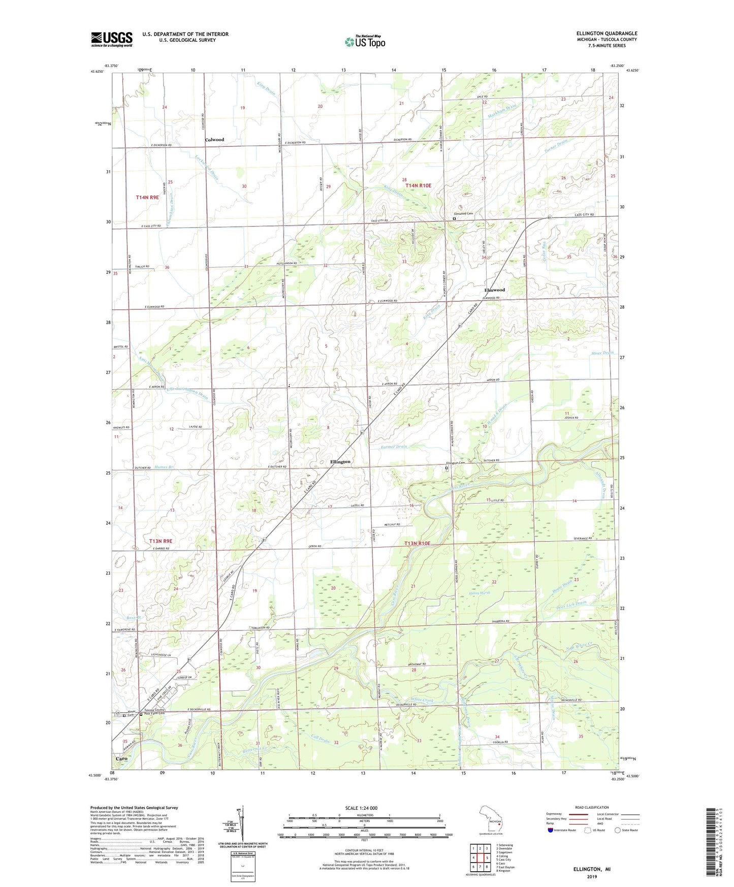
2019 topographic map quadrangle Ellington in the state of Michigan. Scale: 1:24000. Based on the newly updated USGS 7.5' US Topo map series, this map is in the following counties: Tuscola. The map contains contour data, water features, and other items you are used to seeing on USGS maps, but also has updated roads and other features. This is the next generation of topographic maps. Printed on high-quality waterproof paper with UV fade-resistant inks.
Quads adjacent to this one:
West: Colling
Northwest: Sebewaing
North: Owendale
Northeast: Gagetown
East: Cass City
Southeast: Kingston
South: East Dayton
Southwest: Caro
Contains the following named places: Albrandt Drain, Almer Cemetery, Butternut Creek, Call Drain, Camp Pine Acres, Columbian Drain, Colwood, Colwood Church, Colwood Post Office, Colwood United Brethren Church, Deford State Game Area, Doerr Drain, East Branch Anti Mason Drain, Ellington, Ellington Cemetery, Ellington Nazarene Church, Ellington Post Office, Elmwood, Elmwood Cemetery, Elmwood Post Office, Farmer Drain, Frost Drain, George School, H and S Drain, Haidyjz McNeil Drain, Haney Marsh, Hiser Drain, Humes School, King Drain, Lazell Drain, Lockwood Drain, Marker Drain, Markham Drain, Michigan Department of Natural Resources Cass City Field Office, North Branch White Creek, Orr-Moore School, Pinerest Mobile Estates, Reorganized Church of Jesus Christ of Latter Day Saints, South Branch White Creek, Stankul Drain, Sunshine Church, Sutton Church, Township of Ellington, Turner Drain, Tuscola County Poor Farm Cemetery, White Creek