MyTopo
Owendale Michigan US Topo Map
Couldn't load pickup availability
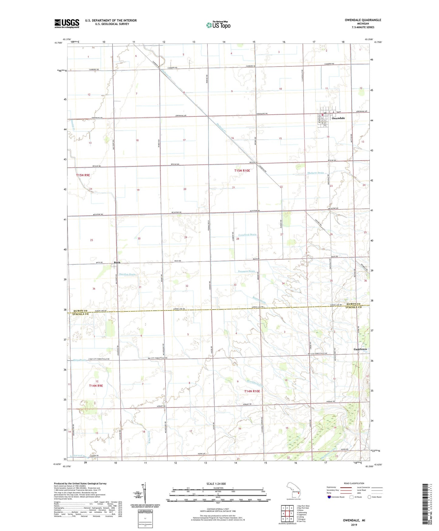
2023 topographic map quadrangle Owendale in the state of Michigan. Scale: 1:24000. Based on the newly updated USGS 7.5' US Topo map series, this map is in the following counties: Huron, Tuscola. The map contains contour data, water features, and other items you are used to seeing on USGS maps, but also has updated roads and other features. This is the next generation of topographic maps. Printed on high-quality waterproof paper with UV fade-resistant inks.
Quads adjacent to this one:
West: Sebewaing
Northwest: Bay Port West
North: Bay Port East
Northeast: Elkton
East: Gagetown
Southeast: Cass City
South: Ellington
Southwest: Colling
This map covers the same area as the classic USGS quad with code o43083f3.
Contains the following named places: Bach, Bach Post Office, Bach Station, Bearss Drain, Borodychuk Drain, Brookfield Exit, Carlton Drain, Columbia Exit, Crawford Drain, Ducolon Drain, Freeman Drain, Owendale, Owendale Fire Department, Owendale Historical Marker, Owendale Post Office, Owendale Station, Owendale-Gagetown High School, Saint Peter Lutheran Church, Saint Peters School, Township of Brookfield, Township of Elmwood, United Methodist Church, Village of Owendale, ZIP Code: 48735