MyTopo
Gagetown Michigan US Topo Map
Couldn't load pickup availability
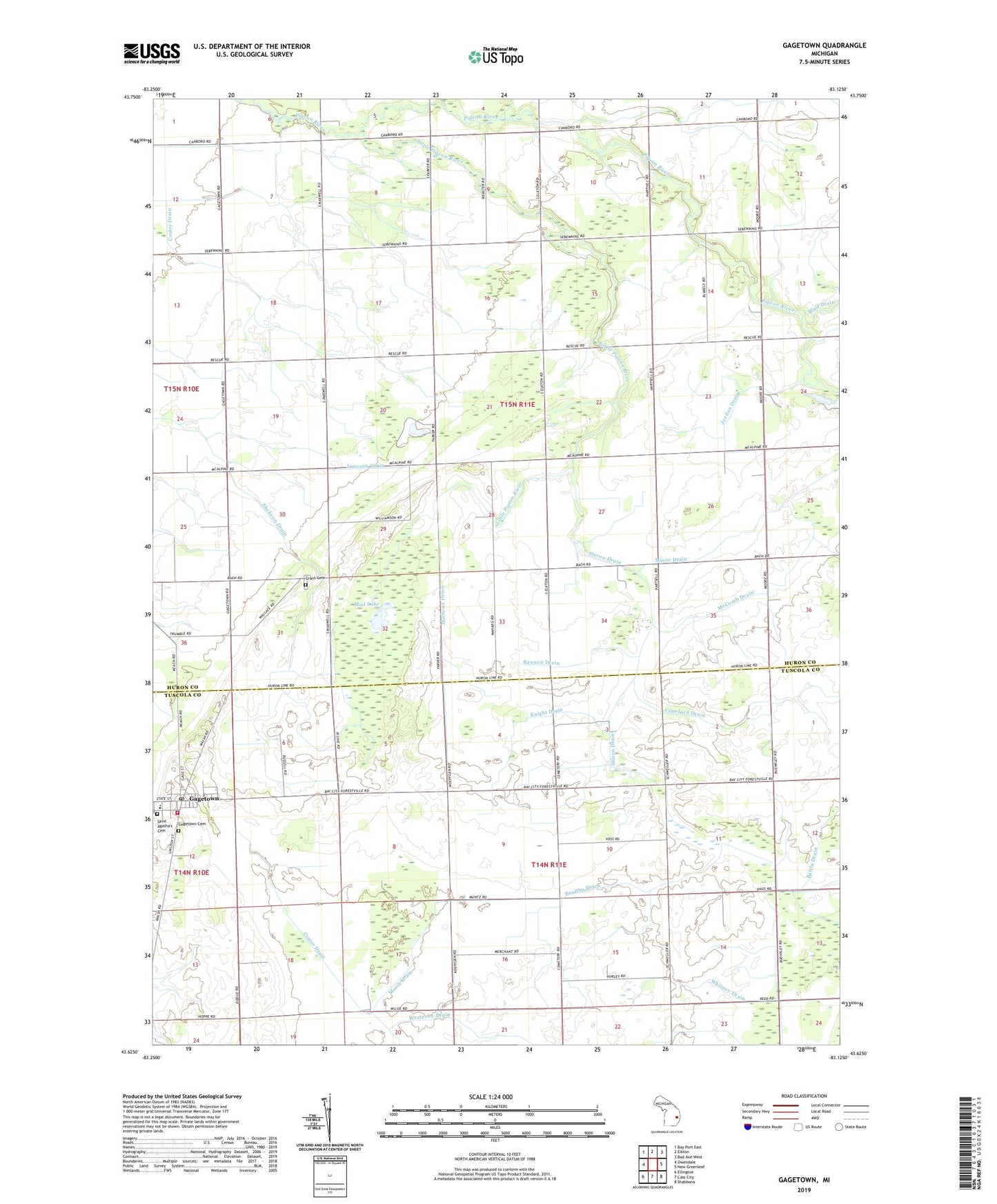
2023 topographic map quadrangle Gagetown in the state of Michigan. Scale: 1:24000. Based on the newly updated USGS 7.5' US Topo map series, this map is in the following counties: Huron, Tuscola. The map contains contour data, water features, and other items you are used to seeing on USGS maps, but also has updated roads and other features. This is the next generation of topographic maps. Printed on high-quality waterproof paper with UV fade-resistant inks.
Quads adjacent to this one:
West: Owendale
Northwest: Bay Port East
North: Elkton
Northeast: Bad Axe West
East: New Greenleaf
Southeast: Shabbona
South: Cass City
Southwest: Ellington
This map covers the same area as the classic USGS quad with code o43083f2.
Contains the following named places: Battle Drain, Boulton Drain, Canboro Post Office, Canboro School, Church of the Nazarene, Columbia Exit, Cooley Drain, Crawford Drain, Elkland Post Office, Elmwood Township Cemetery, Gagetown, Gagetown - Elmwood Township Fire Department, Gagetown Police Department, Gagetown Post Office, Gagetown Public School, Gagetown Station, Gagetown United Methodist Church, Gagetown Village Hall, Grant Cemetery, Grant Church, Greenwood School, Huron Drain, Jameson Drain, Jordan Drain, Knight Drain, Little Pigeon River, Marsh Drain, Mathews Drain, McComb Drain, Moore Drain, Mud Lake, Muntz Drain, Owendale Speedway, Puroy Drain, Rawson Drain, Reorganized Church of Jesus Christ of Latter Days Saints, Rescue, Rescue Post Office, Saint Agatha's Cemetery, Saint Agatha's Church, Shebeon Drain, Sherwood on the Hill Golf Course, Township of Elkland, Township of Grant, Village of Gagetown, Westerby Drain, ZIP Code: 48754