MyTopo
Essexville Michigan US Topo Map
Couldn't load pickup availability
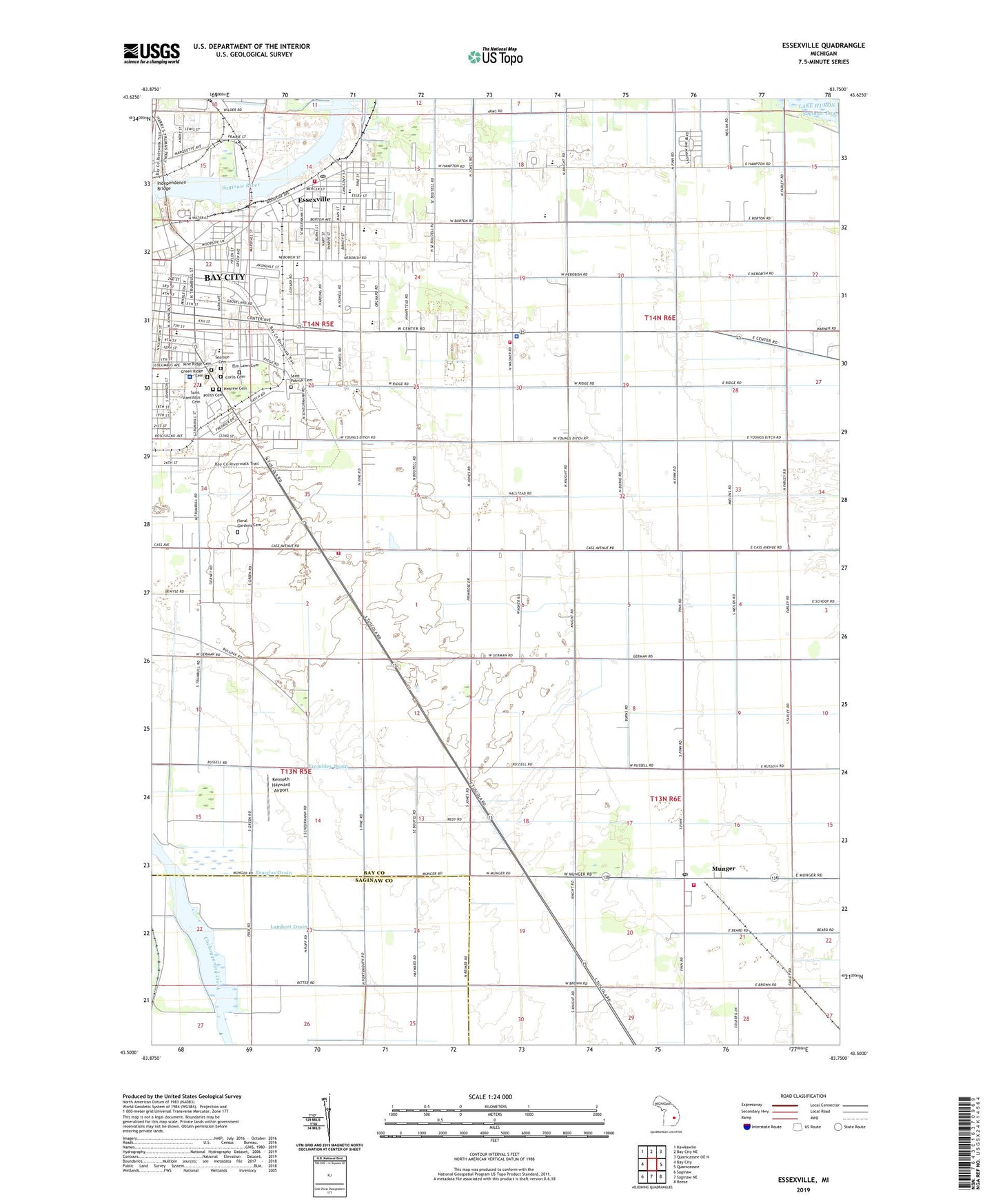
2019 topographic map quadrangle Essexville in the state of Michigan. Scale: 1:24000. Based on the newly updated USGS 7.5' US Topo map series, this map is in the following counties: Bay, Saginaw. The map contains contour data, water features, and other items you are used to seeing on USGS maps, but also has updated roads and other features. This is the next generation of topographic maps. Printed on high-quality waterproof paper with UV fade-resistant inks.
Quads adjacent to this one:
West: Bay City
Northwest: Kawkawlin
North: Bay City NE
Northeast: Quanicassee OE N
East: Quanicassee
Southeast: Reese
South: Saginaw NE
Southwest: Saginaw
Contains the following named places: Aetna Cement Corporation, Amoco Oil Company, Bangor, Banks Post Office, Banks Station, Bay City Boating and Fishing Club Historical Marker, Bay City Station, Bay County Country Club, Bay County Fairground, Bay Medical Care Facility, Bay Regional Medical Mall, Bay Village Mobile Home Estates, Beet Sugar Industry Historical Marker, Bethel Lutheran Church, Carroll Park, Central High School, Charter Township of Portsmouth, City of Essexville, Community Bible Church, Corlis Cemetery, Cramer Junior High School, Douglas Drain, Dow Chemical Refining, Eastside Family Physicians, Elm Lawn Cemetery, Enterprise Oil and Gas Company, Essexville, Essexville Baptist Community Church, Essexville City Hall, Essexville City Police Department, Essexville Department of Public Safety, Essexville Oil Field, Essexville Post Office, Essexville Ridge Lights, Essexville Station, First Baptist Church, First Church of Nazarene, Floral Gardens Cemetery, Garber High School, Gethsemane Missionary Baptist Church, Green Ridge Cemetery, Halstead Drain, Hampton School, Hampton Township Fire Department - Station 8, Hampton Township Police Department, Harold Miller Heliport, Hebrew Cemetery, Hess School, Hughs School, Independence Bridge, Kenneth Hayward Airport, Lambert Drain, McLaren Bay Region Hospital, Merritt School, Merritt Township Fire Department Station 22, Munger, Munger Community Park, Munger Post Office, Munger Station, Nearing Drain, Pilgrim Lutheran Church, Pilgrim Lutheran School, Pine Ridge Cemetery, Polish Cemetery, Portsmouth Township Fire Department, Quanicassee Wildlife Area, Redy Drain, Rupp Oil Company, Saginaw Bay Estates Mobile Home Park, Saint John School, Saint John the Evangelist Church, Saint Luke's United Methodist Church, Saint Norbert Church, Saint Patrick Cemetery, Saint Stanislaus Cemetery, Sand and Store Incorporated, Schoof Drain, Seamon Cemetery, Second Baptist Church, Thomas Jefferson School, Township of Merritt, Trinity School, Trinity-Saint James Lutheran Church, Trombley Drain, United Welders Incorporated, Unity of Bay City Church, Viola Verellen School, Walther Drain, Washington School, WBCM, WBYF-FM (Bay City), WCHW-FM (Bay City), Wenonah Park, Woodside School, WR Bush Elementary School, WXOX-AM (Bay City), ZIP Codes: 48708, 48732, 48747