MyTopo
Quanicassee Michigan US Topo Map
Couldn't load pickup availability
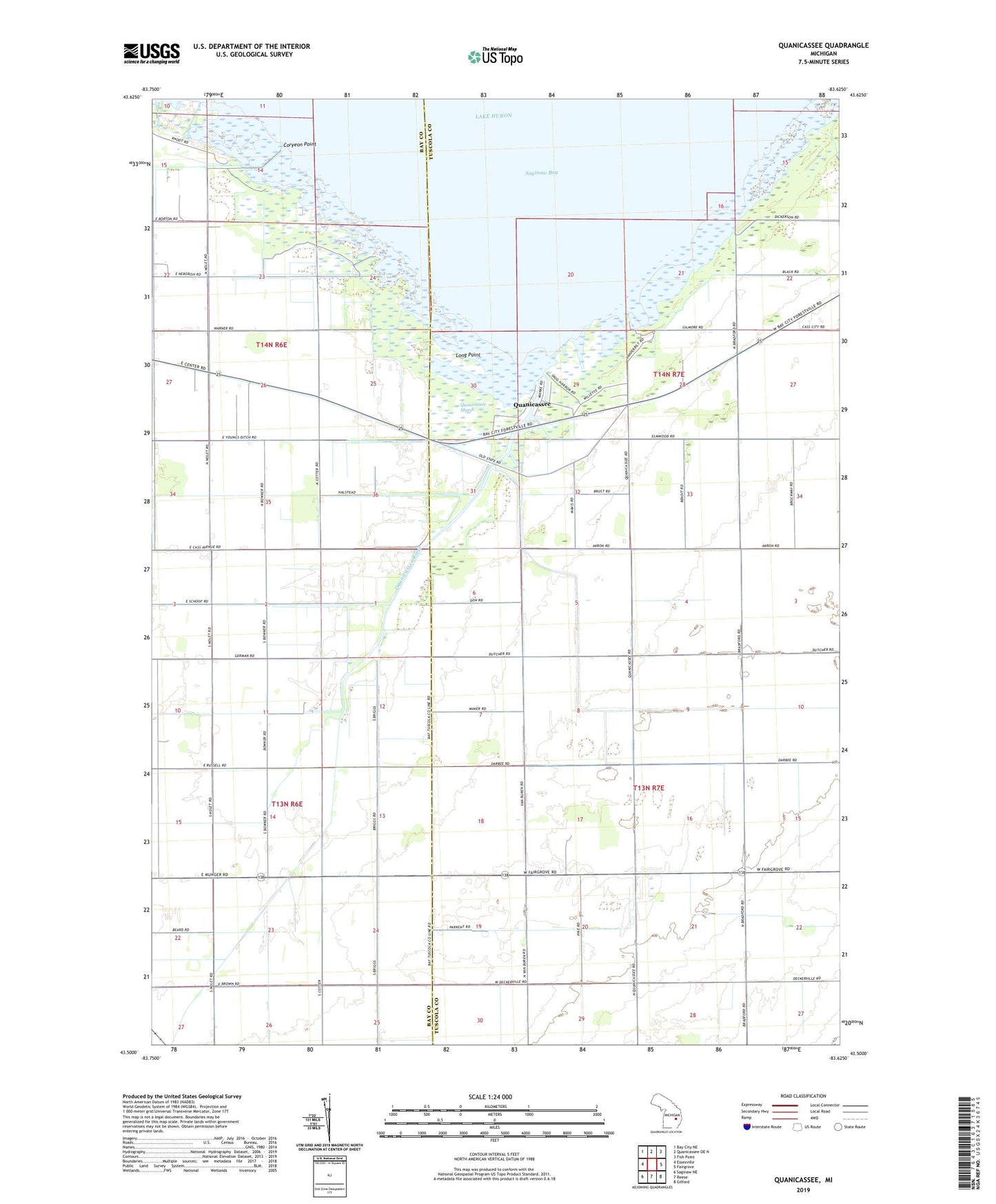
2023 topographic map quadrangle Quanicassee in the state of Michigan. Scale: 1:24000. Based on the newly updated USGS 7.5' US Topo map series, this map is in the following counties: Tuscola, Bay. The map contains contour data, water features, and other items you are used to seeing on USGS maps, but also has updated roads and other features. This is the next generation of topographic maps. Printed on high-quality waterproof paper with UV fade-resistant inks.
Quads adjacent to this one:
West: Essexville
Northwest: Bay City NE
North: Quanicassee OE N
Northeast: Fish Point
East: Fairgrove
Southeast: Gilford
South: Reese
Southwest: Saginaw NE
This map covers the same area as the classic USGS quad with code o43083e6.
Contains the following named places: Church of the Nazarene, Coryeon Point, Hugo Drain, Long Point, Mitchell School, Quanicassee, Quanicassee City Post Office, Quanicassee Marsh, Quanicassee River, Township of Gilford, Township of Wisner, Van Buren School, Vanderbilt Park, WHNN-FM (Bay City), WUCX-FM (Bay City)