MyTopo
Saginaw NE Michigan US Topo Map
Couldn't load pickup availability
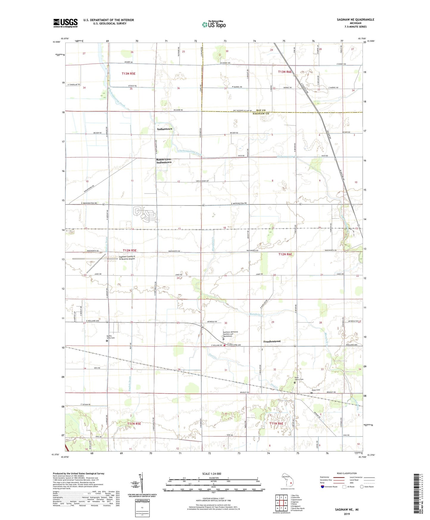
2023 topographic map quadrangle Saginaw NE in the state of Michigan. Scale: 1:24000. Based on the newly updated USGS 7.5' US Topo map series, this map is in the following counties: Saginaw, Bay. The map contains contour data, water features, and other items you are used to seeing on USGS maps, but also has updated roads and other features. This is the next generation of topographic maps. Printed on high-quality waterproof paper with UV fade-resistant inks.
Quads adjacent to this one:
West: Saginaw
Northwest: Bay City
North: Essexville
Northeast: Quanicassee
East: Reese
Southeast: Frankenmuth
South: Birch Run North
Southwest: Bridgeport
This map covers the same area as the classic USGS quad with code o43083d7.
Contains the following named places: Blumfield Creek, Blumfield Township Fire Department, Buena Vista Cemetery, Charter Township of Buena Vista, Cool Creek, Creens Drain, Eastlawn Memorial Gardens and Mausoleum, English Drain, Faulkwood Shores Golf Club, Frankentrost, Immanuel Lutheran Church, Indiantown, Jason Cemetery, Jordon Drain, Kleinart Drain, Kulmbach Post Office, Kulmbach Station, Robin Glen-Indiantown Census Designated Place, Saginaw County H W Browne Airport, Saint John's Cemetery, Saint Matthew Church, Township of Blumfield, Trostville Post Office, Weaver Drain, WIOG-FM (Bay City), WNEM-TV (Bay City), WSGW-AM (Saginaw)