MyTopo
Flower Creek Michigan US Topo Map
Couldn't load pickup availability
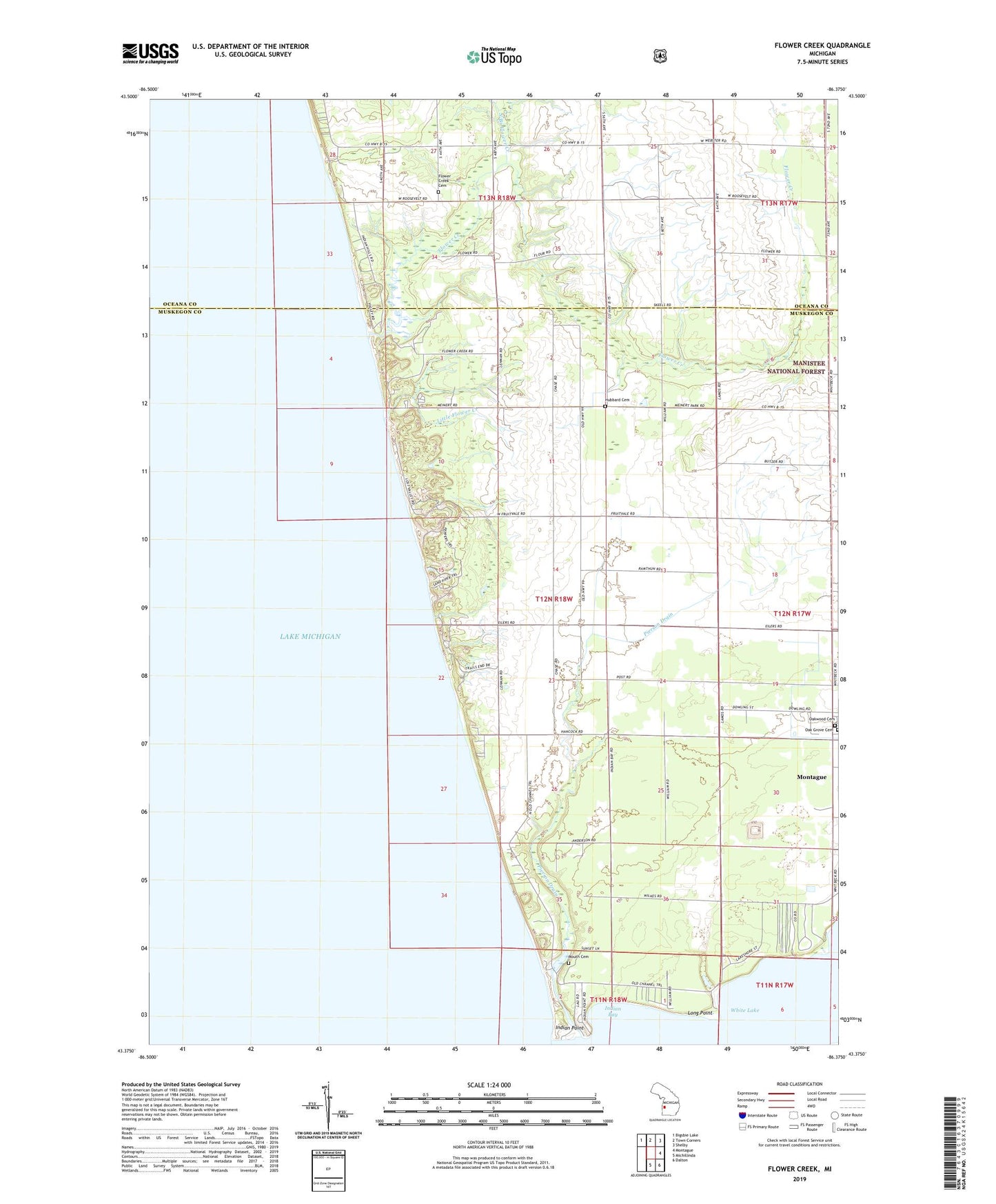
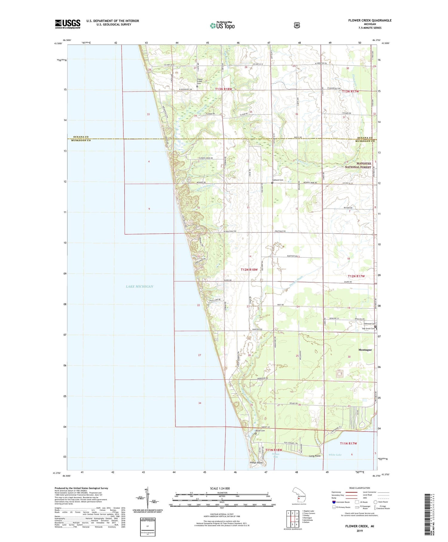
2019 topographic map quadrangle Flower Creek in the state of Michigan. Scale: 1:24000. Based on the newly updated USGS 7.5' US Topo map series, this map is in the following counties: Muskegon, Oceana. The map contains contour data, water features, and other items you are used to seeing on USGS maps, but also has updated roads and other features. This is the next generation of topographic maps. Printed on high-quality waterproof paper with UV fade-resistant inks.
Quads adjacent to this one:
Northwest: Bigsbie Lake
North: Town Corners
Northeast: Shelby
East: Montague
Southeast: Dalton
South: Michillinda
Contains the following named places: Bible Church, Claybanke Church, Dowies Point, Flower Creek, Flower Creek Cemetery, Flower Creek School, Flowercreek Post Office, Green School, Grover Fisheries, Hubbard Cemetery, Indian Bay, Indian Point, Little Flower Creek, Long Point, Medbury Park, Meinert Park, Montague Township Hall, Montague Township Park, Mount School, Mouth Cemetery, Mouth Cemetery Historical Marker, North Branch Flower Creek, North Pier Light, Oak Grove Cemetery, Old Channel Trail Golf Course, Pierson Drain, Pines Campground, Sadony Bayou, Township of White River, White Lake, ZIP Code: 49437