MyTopo
Galien Michigan US Topo Map
Couldn't load pickup availability
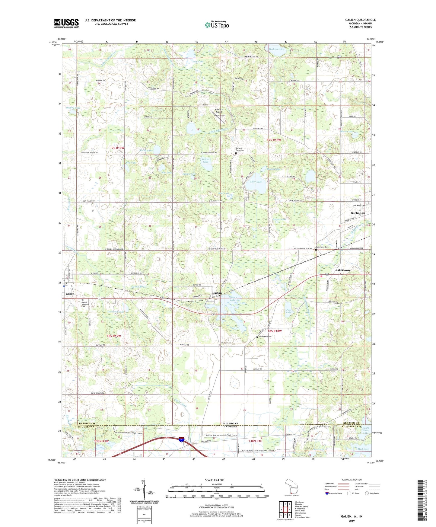
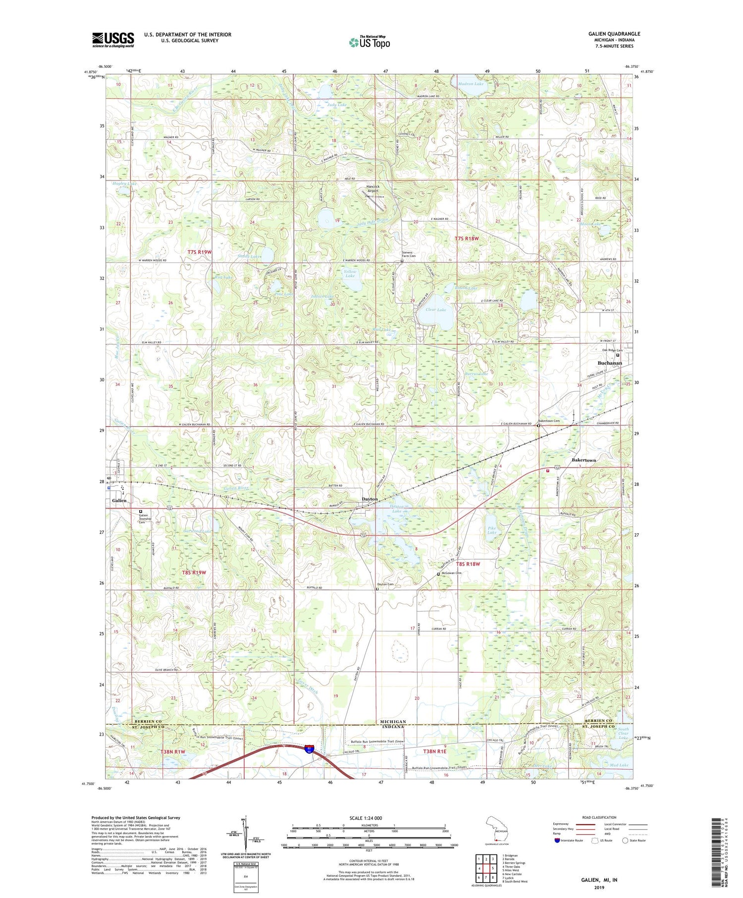
2019 topographic map quadrangle Galien in the states of Michigan, Indiana. Scale: 1:24000. Based on the newly updated USGS 7.5' US Topo map series, this map is in the following counties: Berrien, St. Joseph. The map contains contour data, water features, and other items you are used to seeing on USGS maps, but also has updated roads and other features. This is the next generation of topographic maps. Printed on high-quality waterproof paper with UV fade-resistant inks.
Quads adjacent to this one:
West: Three Oaks
Northwest: Bridgman
North: Baroda
Northeast: Berrien Springs
East: Niles West
Southeast: South Bend West
South: Lydick
Southwest: New Carlisle
Contains the following named places: Bakertown, Bakertown Cemetery, Bakertown Drain, Bertrand Township Fire Department Station 1 Headquarters, Burrus Lake, Camp Madron, Church of the Nazarene, Clear Lake, Dayton, Dayton Cemetery, Dayton Lake, Dayton Post Office, Dayton Station, Deer Lake, East Clear Lake Campground, Galien, Galien High School, Galien Police Department, Galien Post Office, Galien Public Library, Galien Station, Galien Township Cemetery, Galien Township Hall, Galien United Methodist Church, Garwood Lake, Hagley Lake, Hancock Airport, Indian Lake, Judy Lake, Madron Lake, McGowan Cemetery, Moon Lake, Mud Lake, Mud Lake Bog, Oak Ridge Cemetery, Olive Branch Methodist Church, Pike Lake, Pine Lake, Round Lake, Rug Lake, Saint Peters Evangelical Church, Shady Lake, South Clear Lake, Stevens Farm Cemetery, Township of Buchanan, Village of Galien, Wagner Lake, Weaver Lake, Weaver Park, Yellow Lake, ZIP Code: 49107