MyTopo
New Carlisle Indiana US Topo Map
Couldn't load pickup availability
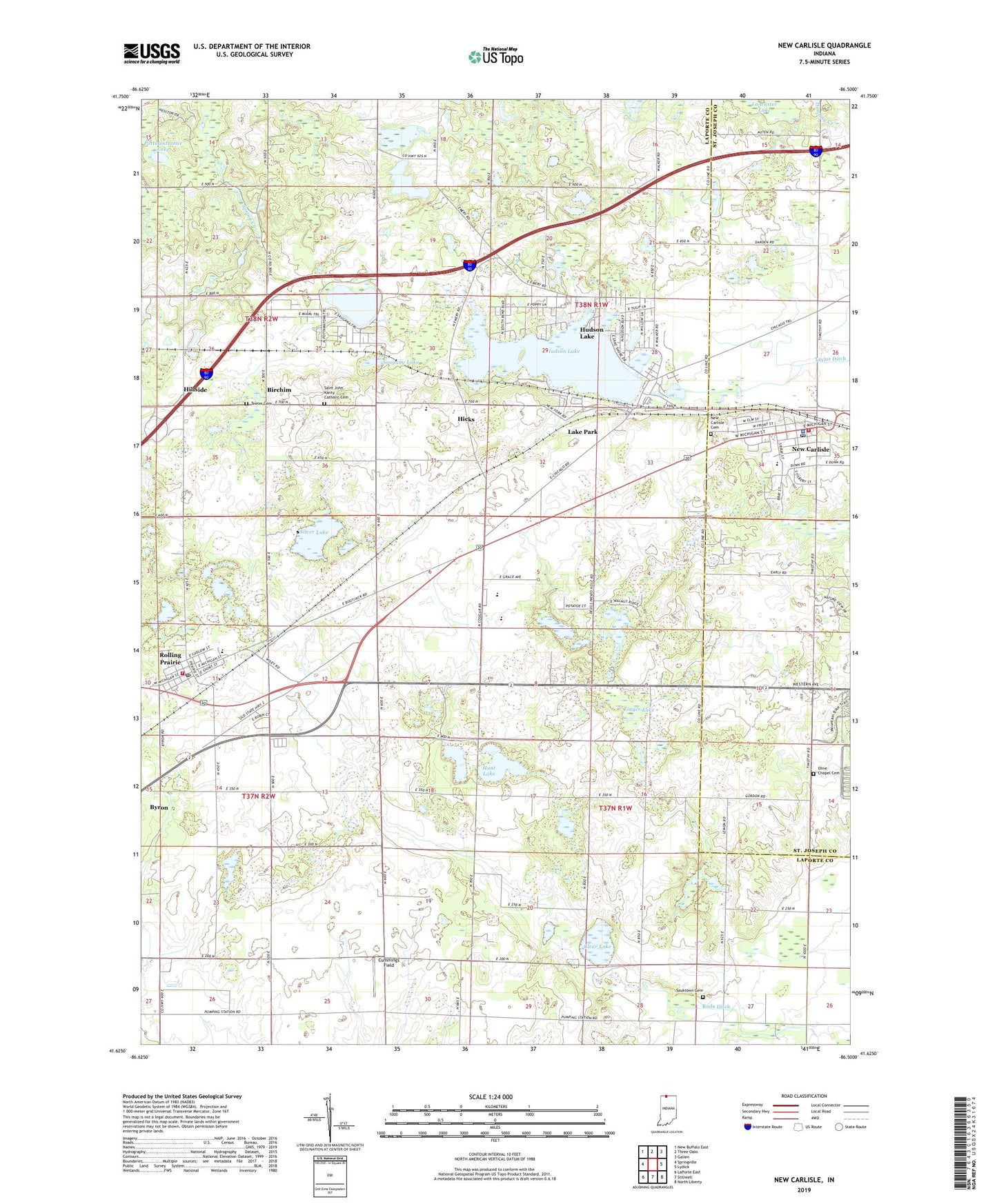
2022 topographic map quadrangle New Carlisle in the state of Indiana. Scale: 1:24000. Based on the newly updated USGS 7.5' US Topo map series, this map is in the following counties: LaPorte, St. Joseph. The map contains contour data, water features, and other items you are used to seeing on USGS maps, but also has updated roads and other features. This is the next generation of topographic maps. Printed on high-quality waterproof paper with UV fade-resistant inks.
Quads adjacent to this one:
West: Springville
Northwest: New Buffalo East
North: Three Oaks
Northeast: Galien
East: Lydick
Southeast: North Liberty
South: Stillwell
Southwest: LaPorte East
This map covers the same area as the classic USGS quad with code o41086f5.
Contains the following named places: Birchim, Byron, Clear Lake, Cummings Field, Finger Lake, Hicks, Hillside, Hudson Lake, Hudson Lake Census Designated Place, Hudson Lake Elementary School, Hunt Lake, Hunt Lake Pit, Kankakee Township Volunteer Fire Department, Lake Park, Maple Grove Church, New Carlisle, New Carlisle Cemetery, New Carlisle Fire Department, New Carlisle Police Department, New Carlisle Post Office, New Prairie High School, New Prairie Junior High School, Olive Chapel, Olive Chapel Cemetery, Olive Township Elementary School, Pottawattamie Lake, Roda Ditch, Rolling Prairie, Rolling Prairie Census Designated Place, Rolling Prairie Elementary School, Rolling Prairie Post Office, Saint John Kanty Catholic Cemetery, Saint Johns Church, Saint Joseph Novitiate, Saugany Lake, Sauktown Cemetery, Sauktown Church, Silver Lake, Teeter Cemetery, Township of Hudson, Township of Wills, ZIP Code: 46371