MyTopo
Gay Michigan US Topo Map
Couldn't load pickup availability
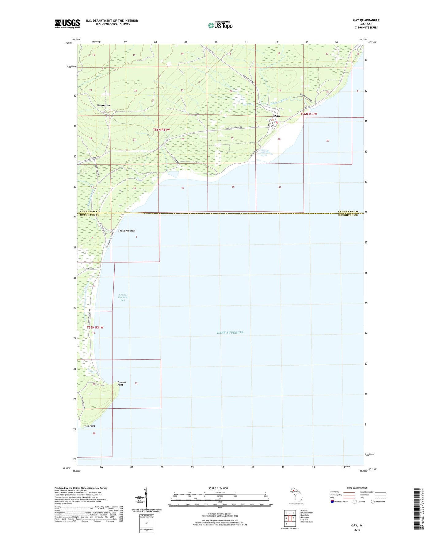
2019 topographic map quadrangle Gay in the state of Michigan. Scale: 1:24000. Based on the newly updated USGS 7.5' US Topo map series, this map is in the following counties: Keweenaw, Houghton. The map contains contour data, water features, and other items you are used to seeing on USGS maps, but also has updated roads and other features. This is the next generation of topographic maps. Printed on high-quality waterproof paper with UV fade-resistant inks.
Quads adjacent to this one:
West: Rice Lake
Northwest: Mohawk
North: Bruneau Creek
Northeast: Deer Lake
East: Gay OE E
Southwest: Traverse Island
Contains the following named places: Gay, Gay Post Office, Gay Station, Grand Traverse Bay, Louis Point, Sherman Township Volunteer Fire Department, Snowshoe, Tobacco River, Traverse Bay, Traverse Point, Traverse River