MyTopo
Traverse Island Michigan US Topo Map
Couldn't load pickup availability
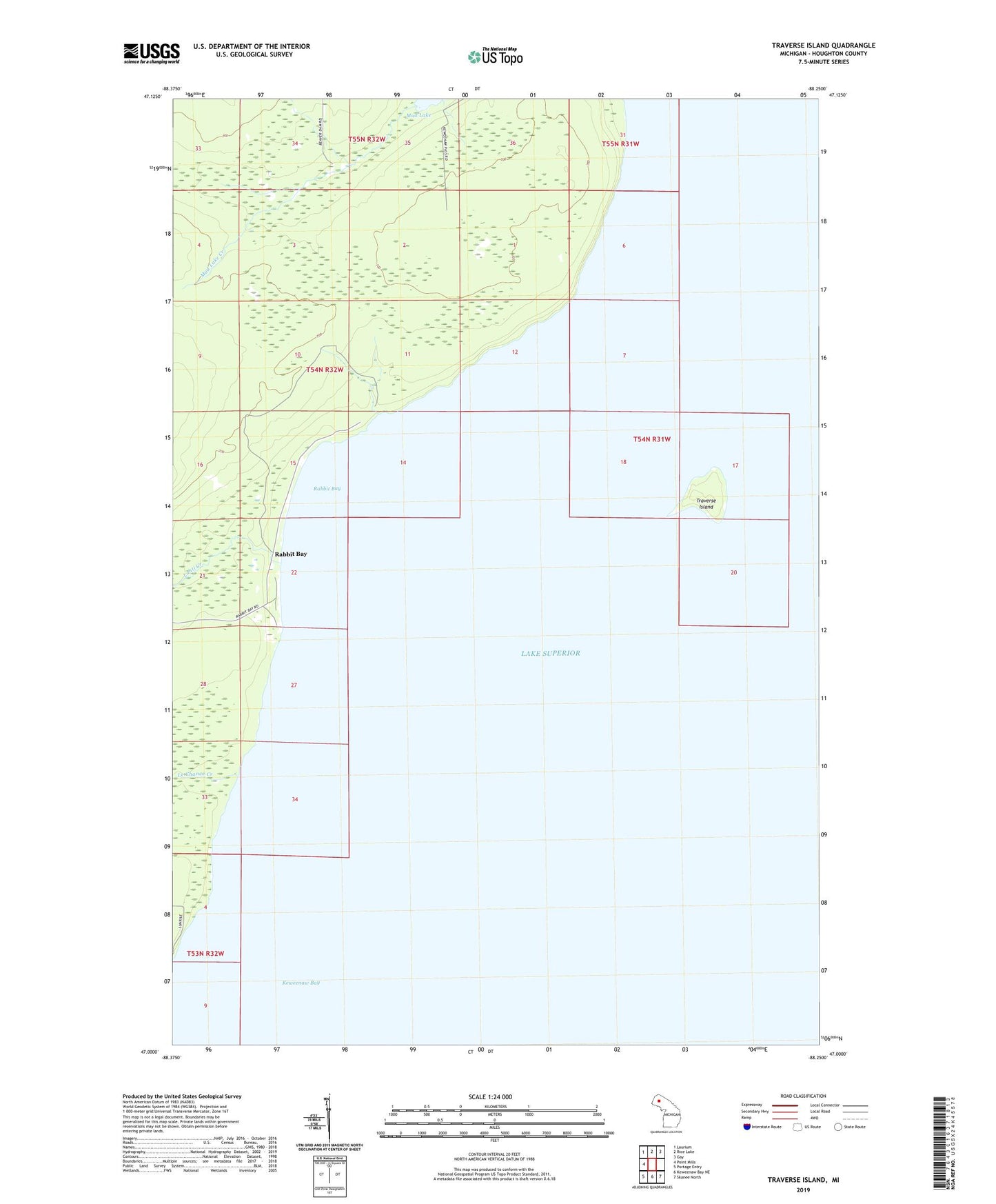
2023 topographic map quadrangle Traverse Island in the state of Michigan. Scale: 1:24000. Based on the newly updated USGS 7.5' US Topo map series, this map is in the following counties: Houghton. The map contains contour data, water features, and other items you are used to seeing on USGS maps, but also has updated roads and other features. This is the next generation of topographic maps. Printed on high-quality waterproof paper with UV fade-resistant inks.
Quads adjacent to this one:
West: Point Mills
Northwest: Laurium
North: Rice Lake
Northeast: Gay
Southeast: Skanee North
South: Keweenaw Bay NE
Southwest: Portage Entry
This map covers the same area as the classic USGS quad with code o47088a3.
Contains the following named places: Lahti Creek, Le Chance Creek, Rabbit Bay, Traverse Island