
MyTopo
Good Harbor Bay Michigan US Topo Map
Couldn't load pickup availability
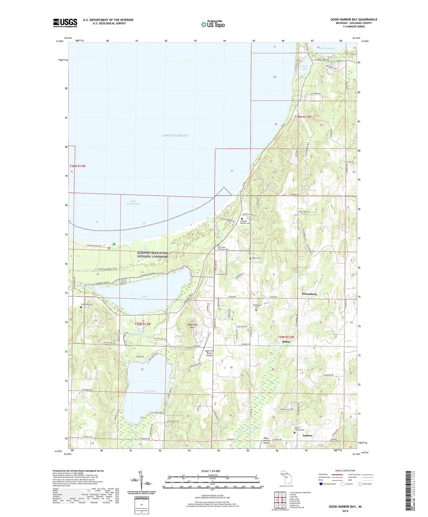
2019 topographic map quadrangle Good Harbor Bay in the state of Michigan. Scale: 1:24000. Based on the newly updated USGS 7.5' US Topo map series, this map is in the following counties: Leelanau. The map contains contour data, water features, and other items you are used to seeing on USGS maps, but also has updated roads and other features. This is the next generation of topographic maps. Printed on high-quality waterproof paper with UV fade-resistant inks.
Quads adjacent to this one:
West: Glen Arbor
Northwest: North Manitou Island OE E
North: Leland
Northeast: Gills Pier
East: Suttons Bay
Southeast: Traverse City SW
South: Maple City
Southwest: Burdickville
Contains the following named places: Bodus, Cleveland Cemetery, Cleveland Township Hall, Community Church, Duck Lake, Good Harbor Bay, Good Harbor Creek, Good Harbor Post Office, Grindstuen Cemetery, Holy Rosary Church, Holy Rosary School, Isadore, Isadore Post Office, Kilwy Cemetery, Kings Challenge Golf Club, Lime Creek, Lime Lake, Lime Lake Campground, Little Traverse Lake, Miller-Herrold Airport, Mount Calvary Cemetery, North University, Saint Paul Lutheran Cemetery, Saint Pauls Church, Schomberg, Schomberg Post Office, Schomberg Station, Shaldas Corner, Shetland Creek, Shetland Post Office, Sleeping Bear Golf Club, Sugar Loaf Resort Airport, Sugarloaf Mountain, Swedish Mission Cemetery, Township of Centerville, WBKP-FM (Leland)


