MyTopo
Burdickville Michigan US Topo Map
Couldn't load pickup availability
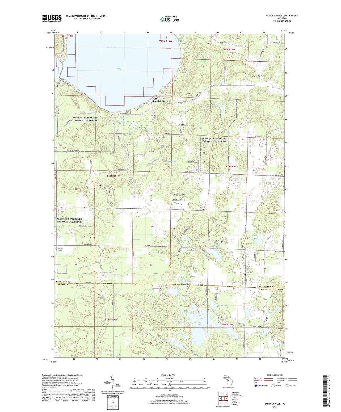
2023 topographic map quadrangle Burdickville in the state of Michigan. Scale: 1:24000. Based on the newly updated USGS 7.5' US Topo map series, this map is in the following counties: Leelanau, Benzie. The map contains contour data, water features, and other items you are used to seeing on USGS maps, but also has updated roads and other features. This is the next generation of topographic maps. Printed on high-quality waterproof paper with UV fade-resistant inks.
Quads adjacent to this one:
West: Empire
Northwest: Glen Haven
North: Glen Arbor
Northeast: Good Harbor Bay
East: Maple City
Southeast: Lake Ann
South: Platte River
Southwest: Beulah
This map covers the same area as the classic USGS quad with code o44085g8.
Contains the following named places: Armstrong Lake, Bland Cemetery, Bow Lake, Brooks Lake, Burdickville, Burdickville Cemetery, Burdickville Post Office, Community Church, Courson Lake, Dodge Spring, Dunes Golf Club, Garey Lake, Gilbert Lake, Glen Lake, Glen Lake Church, Glen Lake High School, Hartman Lake, Holden Lake, Horseshoe Lake, Kasson Center School, Kasson Townhall, Lime Lake, Myles Kimmerly Park, Old Settlers Park Historical Marker, Osborn Post Office, Oviatt Post Office, Pearl Lake, Pearl Lake Natural Area, Polack Lake, Rose Hill Cemetery, Sleepy Bear Campground, Sweet Lake, Tobin Cemetery, Township of Kasson, Varney Hill, Warner Hill, Wells Lake, Wilson Cemetery, Wiltz Lake, WMLB-FM (Glen Arbor), ZIP Code: 49636