MyTopo
Gills Pier Michigan US Topo Map
Couldn't load pickup availability
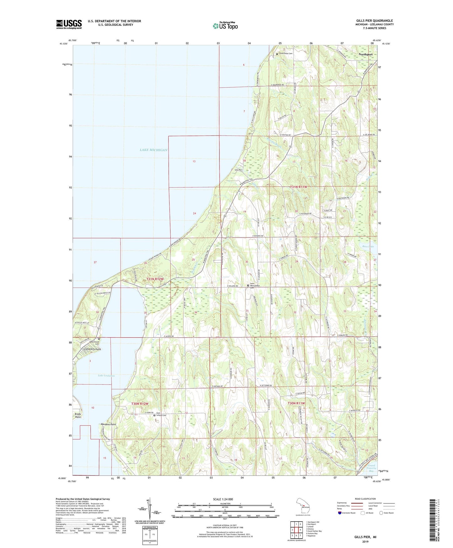
2023 topographic map quadrangle Gills Pier in the state of Michigan. Scale: 1:24000. Based on the newly updated USGS 7.5' US Topo map series, this map is in the following counties: Leelanau. The map contains contour data, water features, and other items you are used to seeing on USGS maps, but also has updated roads and other features. This is the next generation of topographic maps. Printed on high-quality waterproof paper with UV fade-resistant inks.
Quads adjacent to this one:
West: Leland
North: Northport NW
Northeast: Northport
East: Omena
Southeast: Mapleton
South: Suttons Bay
Southwest: Good Harbor Bay
This map covers the same area as the classic USGS quad with code o45085a6.
Contains the following named places: Bartholomew Park, Bass Lake, Beechwood Cemetery, Brady Point, Cemetery Point, Cherry Bay Orchards, East Leland Cemetery, Gills Creek, Gills Pier, Gills Pier Post Office, Houdek Creek, Indian Church, Leland Township Park, Onominese Indian Cemetery, Onomonese Indian Cemetery, Roaring Brook, Saint Wenceslaus Cemetery, Saint Wenceslaus Church, Saint Wenceslaus Church and Cemetery Historical Marker, Sollar School, Wardens Point, Wild Cherry Campground