
MyTopo
Grand Portal Point Michigan US Topo Map
Couldn't load pickup availability
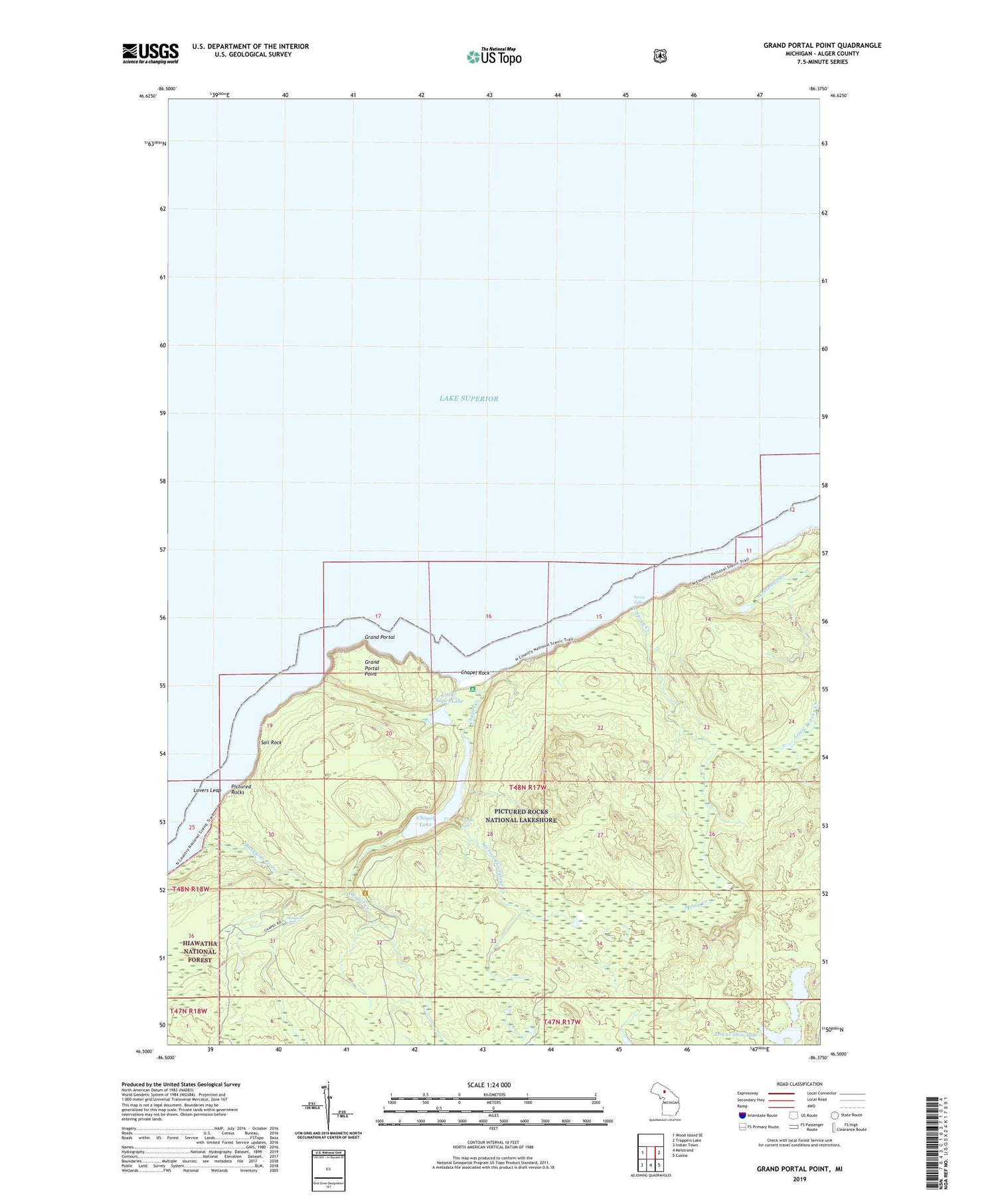
2019 topographic map quadrangle Grand Portal Point in the state of Michigan. Scale: 1:24000. Based on the newly updated USGS 7.5' US Topo map series, this map is in the following counties: Alger. The map contains contour data, water features, and other items you are used to seeing on USGS maps, but also has updated roads and other features. This is the next generation of topographic maps. Printed on high-quality waterproof paper with UV fade-resistant inks.
Quads adjacent to this one:
West: Wood Island SE
East: Trappers Lake
Southeast: Cusino
South: Melstrand
Southwest: Indian Town
Contains the following named places: Chapel Beach Campground, Chapel Creek, Chapel Falls, Chapel Lake, Chapel Rock, Grand Portal, Grand Portal Point, Lakeshore Trail, Little Chapel Lake, Lovers Leap, Lower Shoe Lake, Mosquito Beach Campground, Mosquito Falls, Mosquito River, Pictured Rocks, Sail Rock, Section Thirtyfour Creek, Spray Creek, Spray Falls, Upper Shoe Lake


