MyTopo
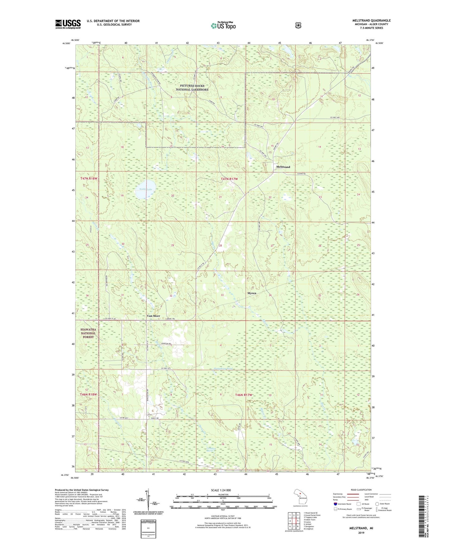
Melstrand Michigan US Topo Map
Couldn't load pickup availability
Also explore the Melstrand Forest Service Topo of this same quad for updated USFS data
2023 topographic map quadrangle Melstrand in the state of Michigan. Scale: 1:24000. Based on the newly updated USGS 7.5' US Topo map series, this map is in the following counties: Alger. The map contains contour data, water features, and other items you are used to seeing on USGS maps, but also has updated roads and other features. This is the next generation of topographic maps. Printed on high-quality waterproof paper with UV fade-resistant inks.
Quads adjacent to this one:
West: Indian Town
Northwest: Wood Island SE
North: Grand Portal Point
Northeast: Trappers Lake
East: Cusino
Southeast: Creighton
South: Shingleton
Southwest: Juniper
This map covers the same area as the classic USGS quad with code o46086d4.
Contains the following named places: Humphrey Pond, Melstrand, Melstrand Post Office, Melstrand Station, Myren, Noble Lake, Van Meer, Williams Crossing