MyTopo
Greenville East Michigan US Topo Map
Couldn't load pickup availability
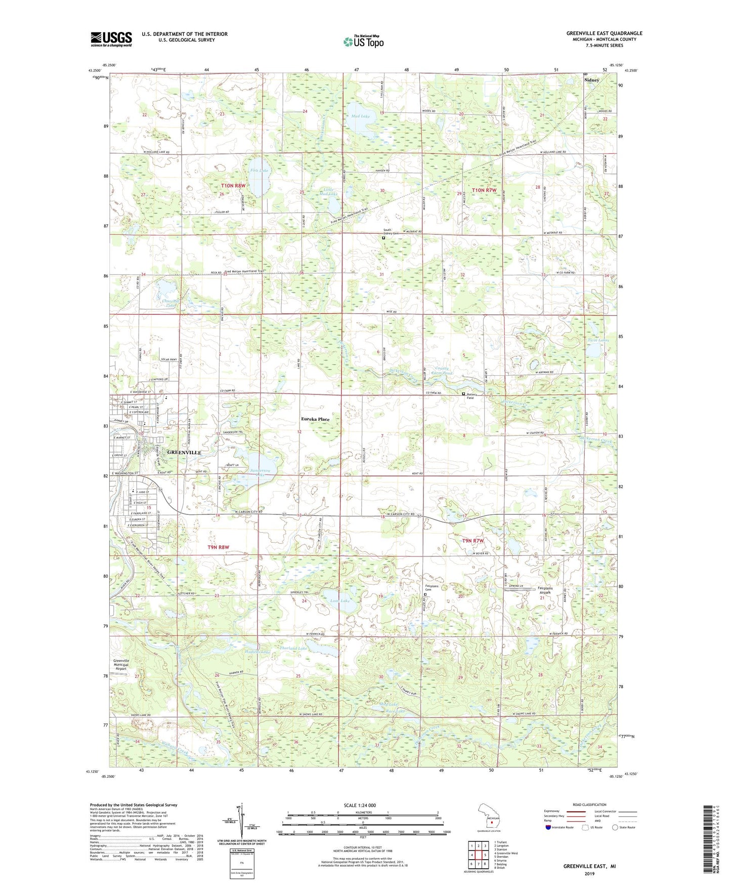
2019 topographic map quadrangle Greenville East in the state of Michigan. Scale: 1:24000. Based on the newly updated USGS 7.5' US Topo map series, this map is in the following counties: Montcalm. The map contains contour data, water features, and other items you are used to seeing on USGS maps, but also has updated roads and other features. This is the next generation of topographic maps. Printed on high-quality waterproof paper with UV fade-resistant inks.
Quads adjacent to this one:
West: Greenville West
Northwest: Trufant
North: Langston
Northeast: Stanton
East: Sheridan
Southeast: Shiloh
South: Belding
Southwest: Smyrna
Contains the following named places: Alan G Davis Park, Cedar Crest School, Chippewa Hills Trailer Court, Church of Jesus Christ, Churchill Lake, County Farm Pond, Daniel Broc Church, Eureka Place, Fair Haven Home, Fairplains Airpark, Fairplains Cemetery, Fairplains Church, Fish Lake, Flat River State Game Area, Friendship Park, Glenkerry Golf Course, Greenville Community Church, Hadicks Lake, Harold Baurie Roadside Park, Holiness Gospel Church, Jackson's Landing, Jesus Non Denominational Church, Kingdom Hall of Jehovah's Witnesses, Little Mud Lake, Loon Lake, Miller Post Office, Millers Station, Mud Lake, New Home Post Office, Oakfield Post Office, Pearl Street Park, Pond View Estates Mobile Home Park, Potter's Field, Race Lake, Reorganized Church of Jesus, Sanderson Lake, Sidney Station, South Sidney Cemetery, Thorland Lake, Three Seasons RV Park, Township of Fairplain, Township of Sidney, Twin Lakes, Walnut Hills School, Wheeler Pit, ZIP Code: 48885