MyTopo
Hemlock Michigan US Topo Map
Couldn't load pickup availability
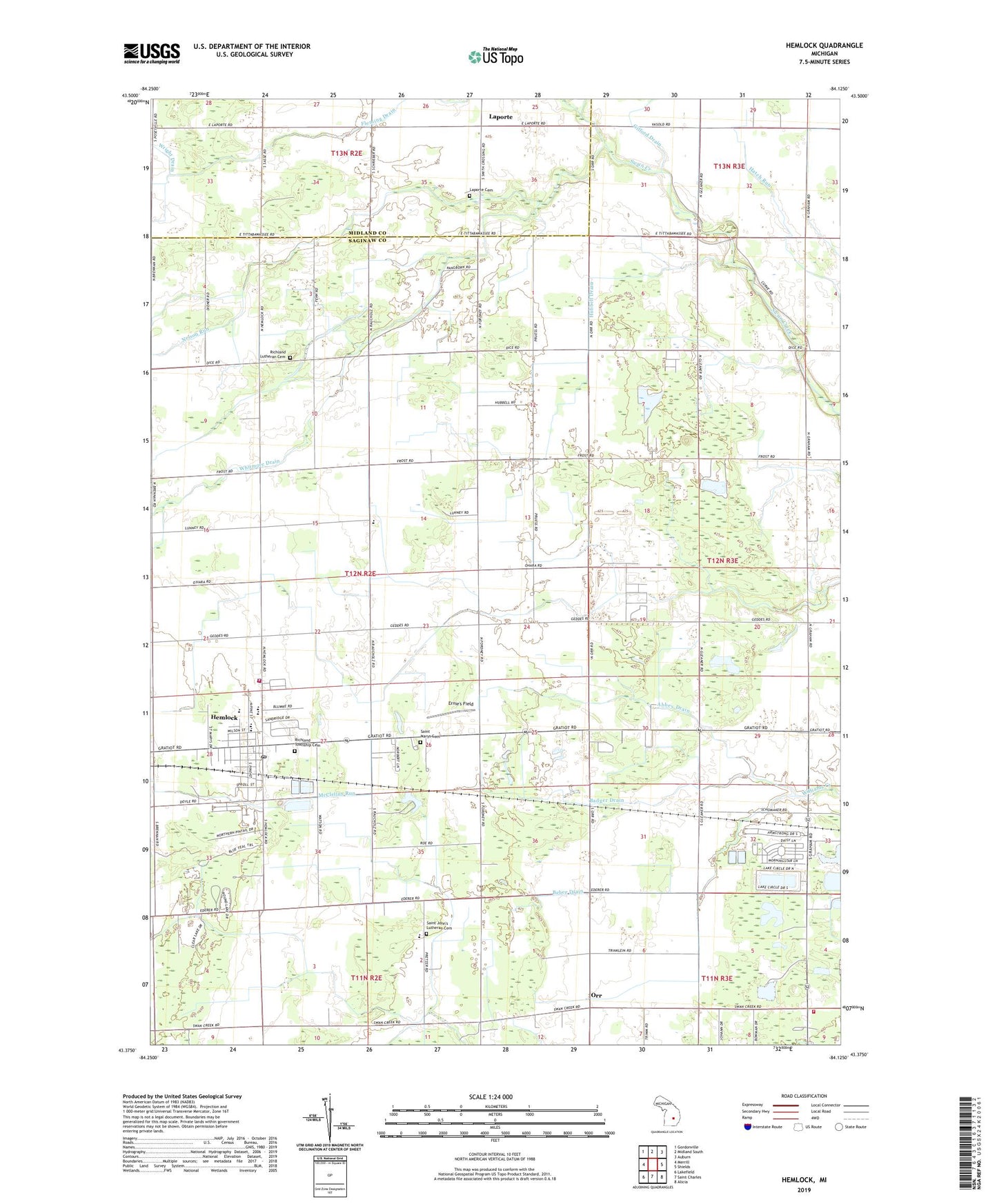
2019 topographic map quadrangle Hemlock in the state of Michigan. Scale: 1:24000. Based on the newly updated USGS 7.5' US Topo map series, this map is in the following counties: Saginaw, Midland. The map contains contour data, water features, and other items you are used to seeing on USGS maps, but also has updated roads and other features. This is the next generation of topographic maps. Printed on high-quality waterproof paper with UV fade-resistant inks.
Quads adjacent to this one:
West: Merrill
Northwest: Gordonville
North: Midland South
Northeast: Auburn
East: Shields
Southeast: Alicia
South: Saint Charles
Southwest: Lakefield
Contains the following named places: Abbey Drain, Badger Drain, Bebee Drain, Calvary Baptist Church, Chapman Drain, Edgewood Village Mobile Home Park, Ernie's Field, Hemlock, Hemlock Census Designated Place, Hemlock Elementary School, Hemlock High School, Hemlock Middle School, Hemlock Post Office, Hemlock Station, Hemlock United Methodist Church, Hubbell Drain, Kenneth C Ling Elementary School, Kris Kay Mobile Home Park, La Porte United Methodist Church, Laporte, Laporte Cemetery, Laporte Post Office, Maple Hill Golf Course, Middle School, Nelson Run, Orr, Pleasant Valley Estates Mobile Home Park, Rauchholz Memorial Library, Richland Lutheran Cemetery, Richland Township Cemetery, Richland Township Fire Department, Richland Township Park, Richland Township Police Department, Saint Johns Church, Saint John's Lutheran Cemetery, Saint Mary Church, Saint Marys Cemetery, Saint Marys School, Saint Peter Lutheran Church, Saint Peter School, Smith Drain, Township of Richland, Tri - Township Fire Department Station 3, ZIP Code: 48626