MyTopo
Gordonville Michigan US Topo Map
Couldn't load pickup availability
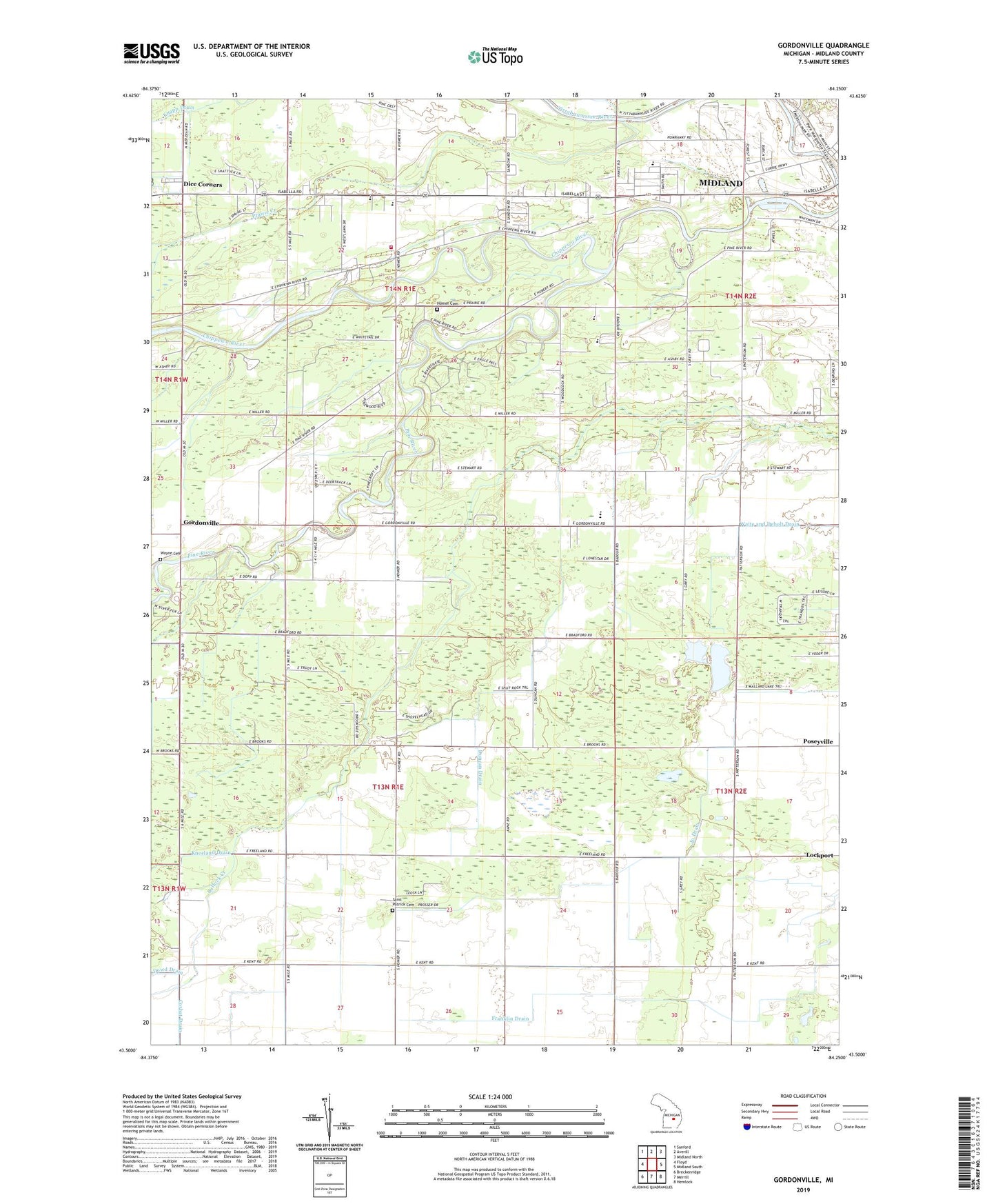
2023 topographic map quadrangle Gordonville in the state of Michigan. Scale: 1:24000. Based on the newly updated USGS 7.5' US Topo map series, this map is in the following counties: Midland. The map contains contour data, water features, and other items you are used to seeing on USGS maps, but also has updated roads and other features. This is the next generation of topographic maps. Printed on high-quality waterproof paper with UV fade-resistant inks.
Quads adjacent to this one:
West: Floyd
Northwest: Sanford
North: Averill
Northeast: Midland North
East: Midland South
Southeast: Hemlock
South: Merrill
Southwest: Breckenridge
This map covers the same area as the classic USGS quad with code o43084e3.
Contains the following named places: Alden B Dow Museum of Science, Arbury Park, Barnes Post Office, Bullock Creek Church, Bullock Creek High School, Bullock Creek Junior High School, Chippewa Nature Center, Chippewassee Park, Chippewassee School, Chippewassee School Park, Country Side Mobile Home Park, Crane Post Office, Currie Municipal Golf Course, Daniel Band Church, Dice Corners, Dice Drain, Dow Gardens, Duncan Drain, Emerson Park, Faith Christian Assembly Church, Faith Wesleyan Church, Franklin Drain, Freeland Drain, Frost Drain, Gordonville, Gordonville Post Office, Gordonville United Methodist Church, Grace Bible Church, Homer Chapel, Homer Church, Homer Township Cemetery, Homer Township Fire Department, Knapp Drain, Midland Mennonite Church, Mount Haley Church, Nease Memorial Church, Pine River, Pine River School, Pine School, Prairie Creek, Revere Park, Riverside Golfside Park, Saint Patrick Cemetery, Snake Creek, Thrune Park, Township of Homer, Township of Mount Haley, Towsley Dike Park, Trinity Church, Upper Bridge Historical Marker, Wayne Cemetery, Windover School, ZIP Code: 48640