
MyTopo
Luther Michigan US Topo Map
Couldn't load pickup availability
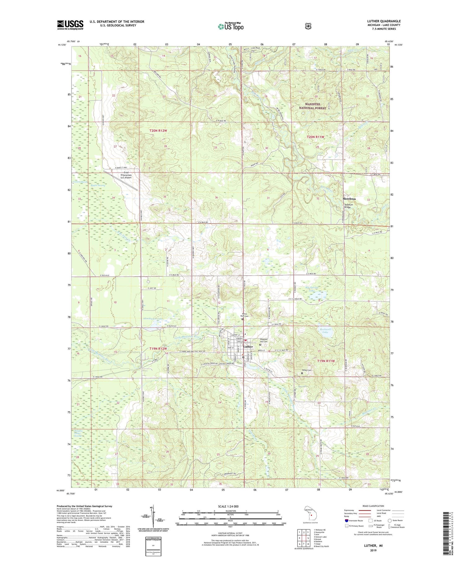
2019 topographic map quadrangle Luther in the state of Michigan. Scale: 1:24000. Based on the newly updated USGS 7.5' US Topo map series, this map is in the following counties: Lake. The map contains contour data, water features, and other items you are used to seeing on USGS maps, but also has updated roads and other features. This is the next generation of topographic maps. Printed on high-quality waterproof paper with UV fade-resistant inks.
Quads adjacent to this one:
West: Stewart Lake
Northwest: Wellston NE
North: Hoxeyville
Northeast: Axin
East: Bristol
Southeast: Reed City North
South: Chase
Southwest: Baldwin
Contains the following named places: Ahmikwam Lake, Baldwin Luther Swamp, Baylor Swamp, Big Spring Lake, Carey Station, Carrieville Recreation Site, Church of Christ, Coe Creek, Evad Enterprises LLC Airport, Fellowship Baptist Church, Hillsdale College Biological Station, Lincoln Creek, Luther, Luther Area Public Library, Luther Elementary School, Luther Fire District 1, Luther Post Office, Luther Station, Luther United Methodist Church, Manistee Creek, Newkirk Township Hall, North Park Cemetery, Pleasant Hill Cemetery, Rockwell Lake, Saint Ignatius Catholic Church, Sellers Creek, Silver Creek, Silver Creek State Forest Campground, Skookum, Skookum Bridge, Totten Post Office, Township of Newkirk, Valley Cemetery, Village of Luther, ZIP Code: 49656


