MyTopo
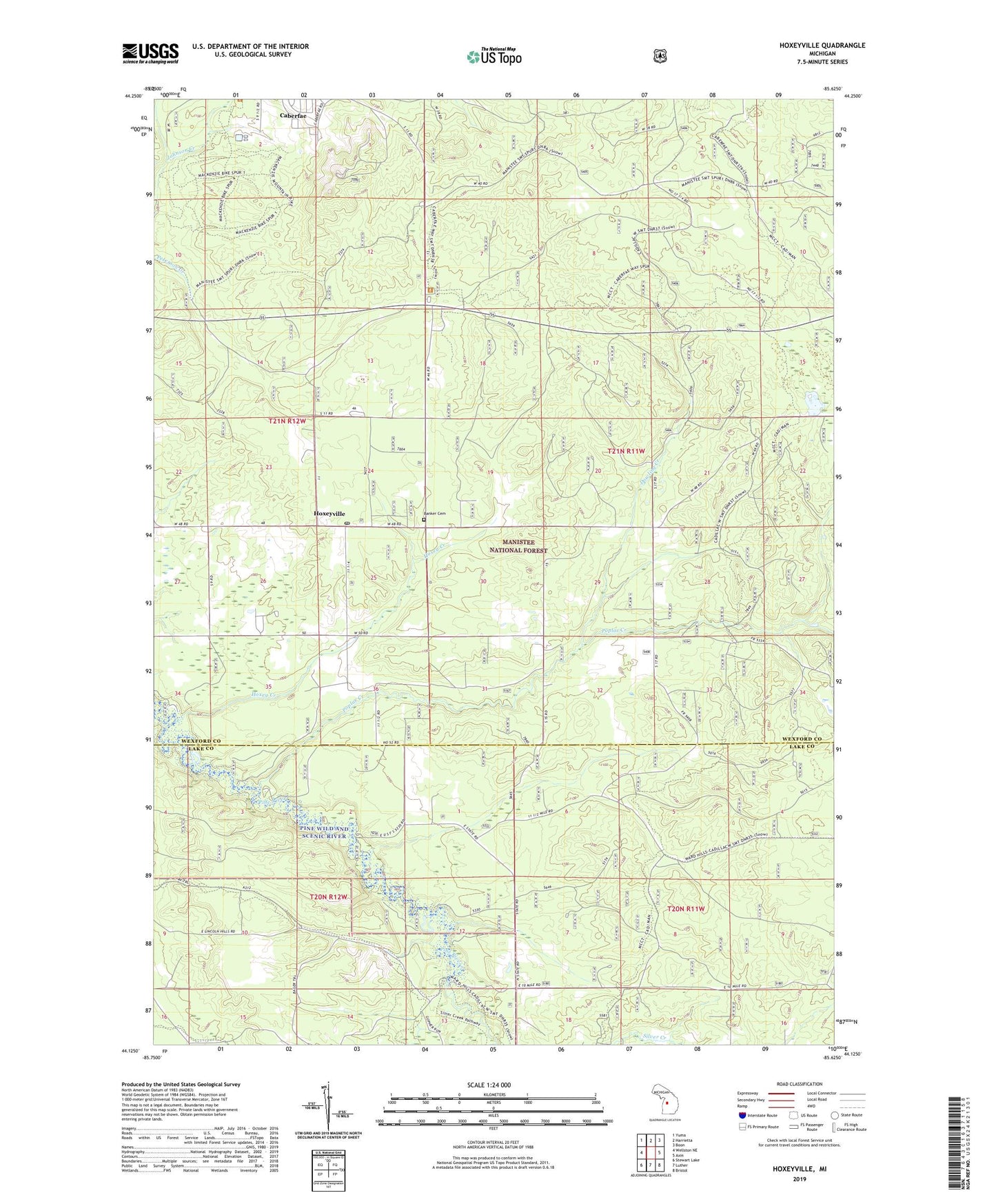
Hoxeyville Michigan US Topo Map
Couldn't load pickup availability
Also explore the Hoxeyville Forest Service Topo of this same quad for updated USFS data
2023 topographic map quadrangle Hoxeyville in the state of Michigan. Scale: 1:24000. Based on the newly updated USGS 7.5' US Topo map series, this map is in the following counties: Wexford, Lake. The map contains contour data, water features, and other items you are used to seeing on USGS maps, but also has updated roads and other features. This is the next generation of topographic maps. Printed on high-quality waterproof paper with UV fade-resistant inks.
Quads adjacent to this one:
West: Wellston NE
Northwest: Yuma
North: Harrietta
Northeast: Boon
East: Axin
Southeast: Bristol
South: Luther
Southwest: Stewart Lake
This map covers the same area as the classic USGS quad with code o44085b6.
Contains the following named places: Angola Post Office, Banker Cemetery, Caberfae Census Designated Place, Caberfae Peaks Ski and Golf Resort, Caberfae Ski Resort Historical Marker, Caberfae Way Trail Parking, Clay Hill Church, Dowling Creek, Elm Flats Canoe Access, Hoxey Creek, Hoxeyville, Hoxeyville Post Office, Kellogg Lookout Tower, Lincoln Bridge Canoe Access, Lincoln Bridge State Forest Campground, McKenzie Ski Trial, Poplar Creek, Ravine Recreation Site, Township of Henderson