MyTopo
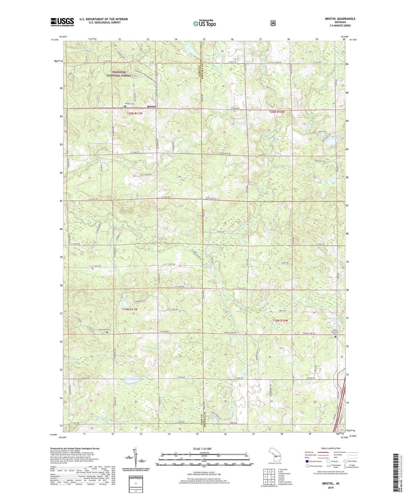
Bristol Michigan US Topo Map
Couldn't load pickup availability
Also explore the Bristol Forest Service Topo of this same quad for updated USFS data
2023 topographic map quadrangle Bristol in the state of Michigan. Scale: 1:24000. Based on the newly updated USGS 7.5' US Topo map series, this map is in the following counties: Osceola, Lake. The map contains contour data, water features, and other items you are used to seeing on USGS maps, but also has updated roads and other features. This is the next generation of topographic maps. Printed on high-quality waterproof paper with UV fade-resistant inks.
Quads adjacent to this one:
West: Luther
Northwest: Hoxeyville
North: Axin
Northeast: Cadillac South
East: Le Roy
Southeast: Slaybaugh Corner
South: Reed City North
Southwest: Chase
This map covers the same area as the classic USGS quad with code o44085a5.
Contains the following named places: Asplund Lake, Beaver Creek, Bristol, Bristol Cemetery, Bristol Post Office, Dewing's, Dewings Post Office, Dewing's Siding, Dover Regular Baptist Church, Dyer Creek, East Branch Pine River, Edgett Church, Edgetts, Edgetts Post Office, Edgetts Station, Ellisworth Cemetery, Harman School, Hewitt Lake, Howe Lake, Keenan Post Office, Keenan Station, LeRoy Township Cemetery, Little Beaver Creek, Marl Bed Lake, North Branch Pine River, Raymond Corners, Riverbank Post Office, Riverbank Station, Sprague Creek, Township of Burdell, Township of Dover, Township of Ellsworth, Township of Le Roy