MyTopo
Manistique West Michigan US Topo Map
Couldn't load pickup availability
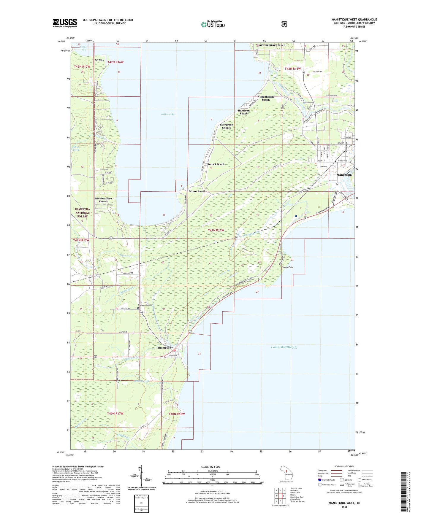
2019 topographic map quadrangle Manistique West in the state of Michigan. Scale: 1:24000. Based on the newly updated USGS 7.5' US Topo map series, this map is in the following counties: Schoolcraft. The map contains contour data, water features, and other items you are used to seeing on USGS maps, but also has updated roads and other features. This is the next generation of topographic maps. Printed on high-quality waterproof paper with UV fade-resistant inks.
Quads adjacent to this one:
West: Cooks
Northwest: Thunder Lake
North: Hiawatha
Northeast: Smith Lake
East: Manistique East
South: Point Aux Barques
Southwest: Hiram Point
Contains the following named places: Ash Point, Bishop Baraga's First Church Historical Marker, City of Manistique, Copenhagen Beach, Dufour Creek, Evergreen Shores, Faith Church, Harrison Beach, Hiawatha School, Hiawatha Shores, Indian Lake, Indian Lake Campground, Indian Lake State Park, Indian Lake State Park Campground, Indian Lake Travel Resort Campground, Johnson Creek, Lincoln Elementary School, Little Smelt Creek, Manistique Bible Church, Manistique Station, Michiwaukee Shores, Minor Beach, Ossawinamakee Beach, Rogers Park, Schoolcraft Historical Museum, Schoolcraft Memorial Hospital, South Manistique Post Office, South Manistique Station, Southtown Creek, Stony Point, Sunset Beach, Thompson, Thompson Cemetery, Thompson Creek, Thompson Post Office, Thompson State Fish Hatchery, Thompson Township Fire Department, Thompson/Christmas Tree Ship Historical Marker, Williams Creek, WTIQ-AM (Manistique), WTIQ-FM (Gulliver)