MyTopo
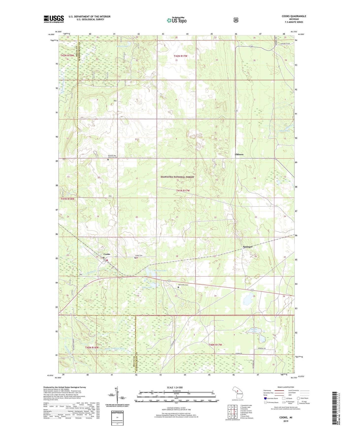
Cooks Michigan US Topo Map
Couldn't load pickup availability
Also explore the Cooks Forest Service Topo of this same quad for updated USFS data
2023 topographic map quadrangle Cooks in the state of Michigan. Scale: 1:24000. Based on the newly updated USGS 7.5' US Topo map series, this map is in the following counties: Schoolcraft, Delta. The map contains contour data, water features, and other items you are used to seeing on USGS maps, but also has updated roads and other features. This is the next generation of topographic maps. Printed on high-quality waterproof paper with UV fade-resistant inks.
Quads adjacent to this one:
West: Garden Corners
Northwest: Gooseneck Lake
North: Thunder Lake
Northeast: Hiawatha
East: Manistique West
Southeast: Point Aux Barques
South: Hiram Point
Southwest: Garden
This map covers the same area as the classic USGS quad with code o45086h4.
Contains the following named places: Cooks, Cooks Cemetery, Cooks Congregational Church, Cooks Lookout Tower, Cooks Post Office, Cooks School, Cooks Station, Cornell Lake, Elkhorn, Grass Lake, Hartman Creek, Inwood Township Fire Department, Michaud Lake, Ninemile Lake, Old Cooks Cemetery, Seventh Day Adventist Cemetery, Silver Creek, Springer, Tighe Lake, WTIQ-FM (Gulliver), ZIP Code: 49817