MyTopo
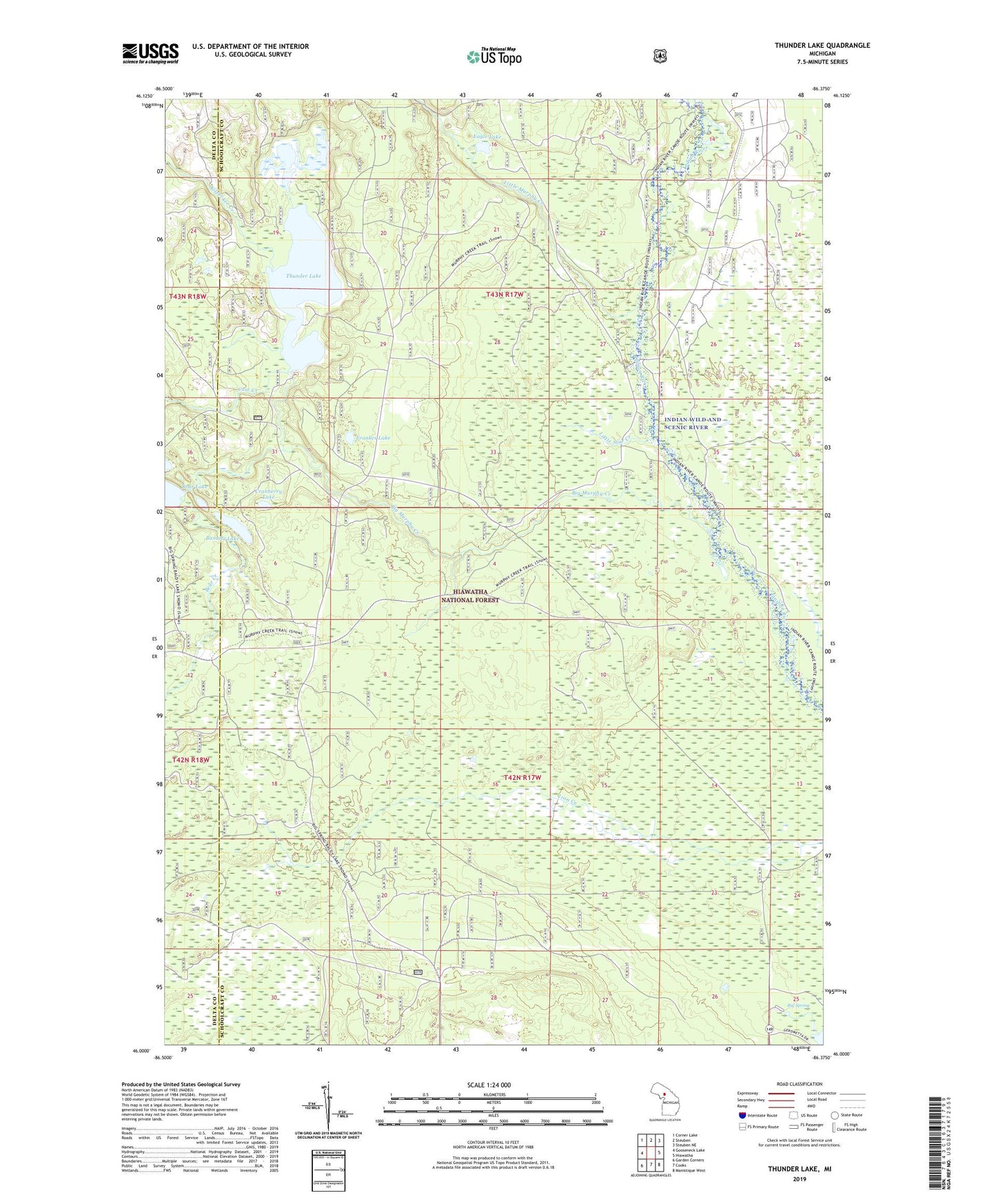
Thunder Lake Michigan US Topo Map
Couldn't load pickup availability
Also explore the Thunder Lake Forest Service Topo of this same quad for updated USFS data
2023 topographic map quadrangle Thunder Lake in the state of Michigan. Scale: 1:24000. Based on the newly updated USGS 7.5' US Topo map series, this map is in the following counties: Schoolcraft, Delta. The map contains contour data, water features, and other items you are used to seeing on USGS maps, but also has updated roads and other features. This is the next generation of topographic maps. Printed on high-quality waterproof paper with UV fade-resistant inks.
Quads adjacent to this one:
West: Gooseneck Lake
Northwest: Corner Lake
North: Steuben
Northeast: Steuben NE
East: Hiawatha
Southeast: Manistique West
South: Cooks
Southwest: Garden Corners
This map covers the same area as the classic USGS quad with code o46086a4.
Contains the following named places: Banana Lake, Bear Creek, Bear Lake, Big Murphy Creek, Big Spring, Carr Creek, Cranberry Lake, Eagle Lake, Frankes Lake, Kilpecker Creek, Little Murphy Creek, Little Star Creek, Richardsons Mill, Thunder Lake, Township of Inwood, Upper Thunder Lake