
MyTopo
Maple City Michigan US Topo Map
Couldn't load pickup availability
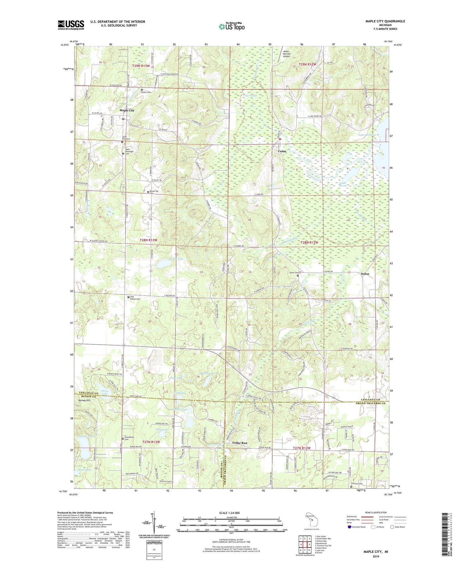
2019 topographic map quadrangle Maple City in the state of Michigan. Scale: 1:24000. Based on the newly updated USGS 7.5' US Topo map series, this map is in the following counties: Leelanau, Grand Traverse, Benzie. The map contains contour data, water features, and other items you are used to seeing on USGS maps, but also has updated roads and other features. This is the next generation of topographic maps. Printed on high-quality waterproof paper with UV fade-resistant inks.
Quads adjacent to this one:
West: Burdickville
Northwest: Glen Arbor
North: Good Harbor Bay
Northeast: Suttons Bay
East: Traverse City SW
Southeast: Grawn
South: Lake Ann
Southwest: Platte River
Contains the following named places: Black Lake, Bright Lake, Cedar, Cedar Area Fire and Rescue, Cedar Census Designated Place, Cedar Post Office, Cedar Run, Cedar Run Post Office, Cedar Run School, Cedar Run Station, Cedar Swamp, Clearbrook Creek, Cook Lake, Davis Lake, East Kasson Cemetery, Friend Post Office, Greenbrier Cemetery, Hart Lake, Kasson Cemetery, Leelanau Christian Fellowship Church, Linwood Cemetery, Maple City, Maple City Census Designated Place, Maple City Community Church, Maple City Post Office, Nash - Pettengill Cemetery, Pikes Lake, Round Top Cemetery, Saint Rita Cemetery, Saint Rita's Church, Shisler Lake, Shorter Lake, Solon, Solon Cemetery, Solon Post Office, Solon Station, Solon Swamp, Stevens Lake, Township of Solon, Victoria Creek, Vlack Memorial Park, West Side Community Church, ZIP Code: 49621


