MyTopo
Platte River Michigan US Topo Map
Couldn't load pickup availability
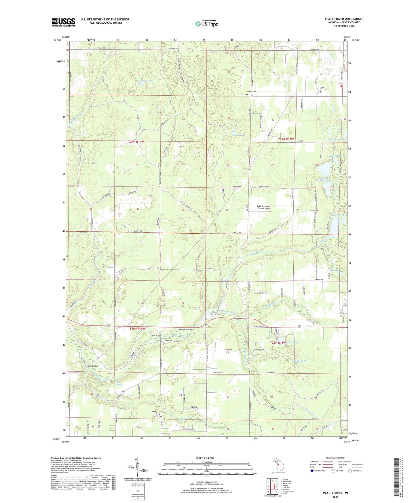
2023 topographic map quadrangle Platte River in the state of Michigan. Scale: 1:24000. Based on the newly updated USGS 7.5' US Topo map series, this map is in the following counties: Benzie. The map contains contour data, water features, and other items you are used to seeing on USGS maps, but also has updated roads and other features. This is the next generation of topographic maps. Printed on high-quality waterproof paper with UV fade-resistant inks.
Quads adjacent to this one:
West: Beulah
Northwest: Empire
North: Burdickville
Northeast: Maple City
East: Lake Ann
Southeast: Karlin
South: Thompsonville
Southwest: Benzonia
This map covers the same area as the classic USGS quad with code o44085f8.
Contains the following named places: Allyn, Almira Cemetery, Almira Church, Almira Post Office, Almira School, Almira Township Volunteer Fire Department, Bear Lake Christian Church, Bell Lake, Benzie County Emergency Medical Services House 2, Bronson Lake, Brundage Cemetery, Brundage Creek, Camp Chenaniah, Carter Creek, Case Bridge, Clarks Mill, Drake School, Eliza Lake, Elm Grove Church, Harvey Lake, Haze Bridge, Honor Congregation of Jehovah's Witnesses, Hooker Lake, Kinney Creek, Lake Ann Airway Estates Airport, Lake Ann Camp, Lake Louise, Lower Woodcock Lake, Memorial Park, Michigan Department of Natural Resources Platte River Office, Mistwood Golf Course, Northstar Mobile Home Park, Pacific Salmon Historical Marker, Pere Marquette State Forest, Pigeon Lake, Platte River, Platte River Campground, Platte River State Fish Hatchery, Platte Springs, Platte Township Hall, Reorganized Church, Stanley Creek, Sunnywoods Resort and Campground, Tarnwood Lake, Township of Almira, Township of Homestead, Township of Inland, Township of Platte, Upper Woodcock Lake, Veterans Park, Woodside Wesleyan Church, ZIP Code: 49650