MyTopo
Marlborough Michigan US Topo Map
Couldn't load pickup availability
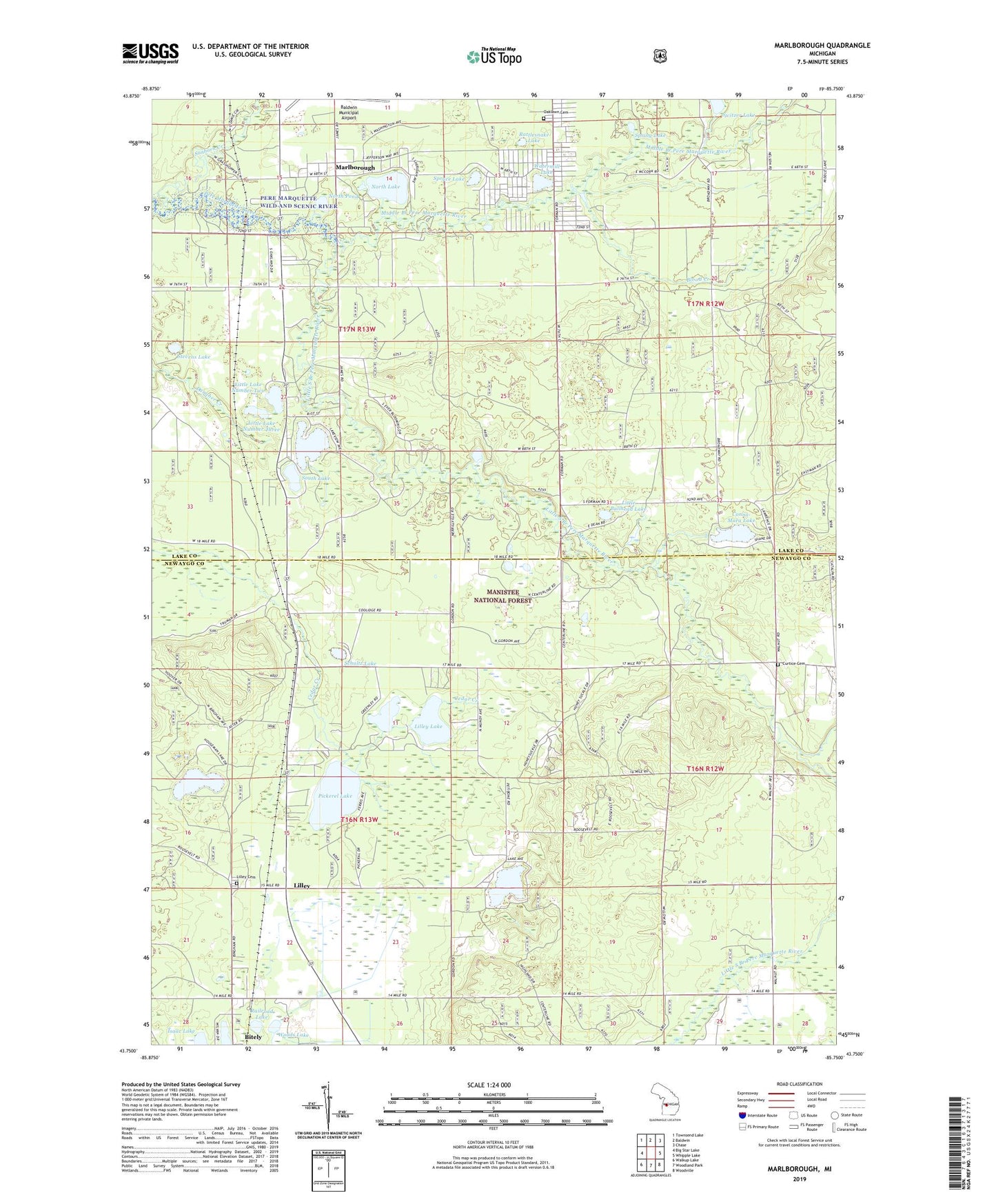
2019 topographic map quadrangle Marlborough in the state of Michigan. Scale: 1:24000. Based on the newly updated USGS 7.5' US Topo map series, this map is in the following counties: Newaygo, Lake. The map contains contour data, water features, and other items you are used to seeing on USGS maps, but also has updated roads and other features. This is the next generation of topographic maps. Printed on high-quality waterproof paper with UV fade-resistant inks.
Quads adjacent to this one:
West: Big Star Lake
Northwest: Townsend Lake
North: Baldwin
Northeast: Chase
East: Whipple Lake
Southeast: Woodville
South: Woodland Park
Southwest: Walkup Lake
Contains the following named places: Alderson Post Office, Alderson Station, Baldwin Assembly of God Church, Blood Creek, Brown Trout Historical Marker, Conna-Mara Lake, Curtice Cemetery, Forks Public Access, Grace Lutheran Church, Houseman Lake, Jackson Corners, Jewell Post Office, Jewell Station, Lilley, Lilley Cemetery, Lilley Lake, Lilley Post Office, Lilley Station, Little Bullhead Lake, Little Lake Number One, Little Lake Number Three, Little Lake Number Two, Little South Branch Pere Marquette River, Marlboro Post Office, Marlborough, Marlborough Station, Middle Branch Pere Marquette River, Mowby Lake, North Lake, North Pond, Oaklawn Cemetery, Pease Creek, Pettibone Lake, Pettibone Lake Park, Pettibone Park Campground, Pickerel Lake, Pickerel Lakeside Campground and Cottages, Railroad Lake, Rattlesnake Lake, Riverside School, Sanborn Creek, Schultz Lake, Shrine of the Pines, Sisson Lake, South Lake, Spring Lake, Spruce Lake, Stevens Lake, Switzer Lake, Township of Lilley, Township of Pleasant Plains, Watermill Lake, Whispering Oaks Campground and Cabins, Woods Lake, ZIP Code: 49642