MyTopo
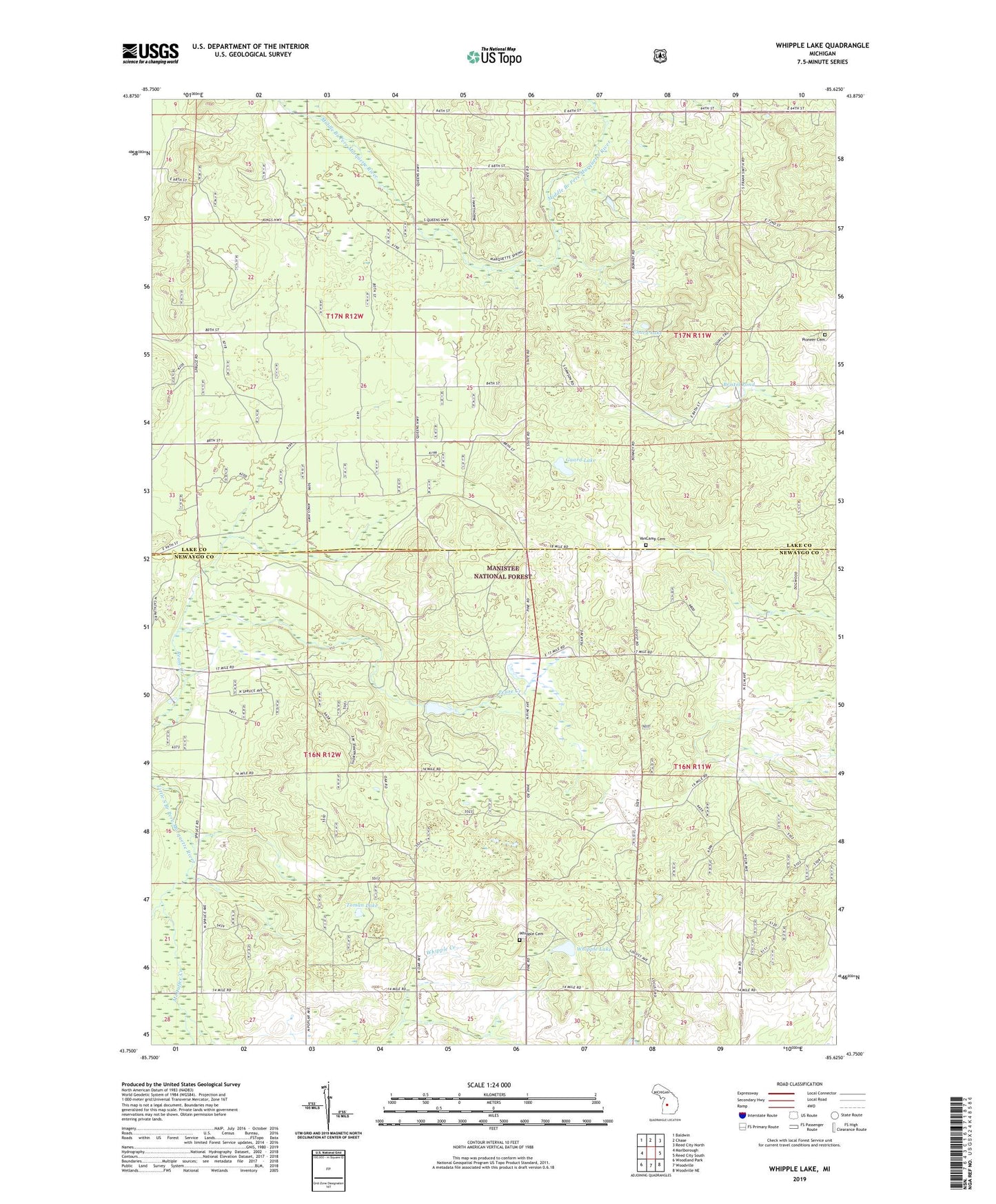
Whipple Lake Michigan US Topo Map
Couldn't load pickup availability
Also explore the Whipple Lake Forest Service Topo of this same quad for updated USFS data
2023 topographic map quadrangle Whipple Lake in the state of Michigan. Scale: 1:24000. Based on the newly updated USGS 7.5' US Topo map series, this map is in the following counties: Newaygo, Lake. The map contains contour data, water features, and other items you are used to seeing on USGS maps, but also has updated roads and other features. This is the next generation of topographic maps. Printed on high-quality waterproof paper with UV fade-resistant inks.
Quads adjacent to this one:
West: Marlborough
Northwest: Baldwin
North: Chase
Northeast: Reed City North
East: Reed City South
Southeast: Woodville NE
South: Woodville
Southwest: Woodland Park
This map covers the same area as the classic USGS quad with code o43085g6.
Contains the following named places: Bristol Pond, Chard Lake, Cook's Station Post Office, Guard Lake, Intimidator Golf Course, McDuffee Creek, Norway Hall Post Office, Norway Hall School, Pioneer Cemetery, Stone School, Toman Lake, Township of Home, Township of Yates, VanCamp Cemetery, Whipple Cemetery, Whipple Lake, Yates Lookout Tower