MyTopo
Mosherville Michigan US Topo Map
Couldn't load pickup availability
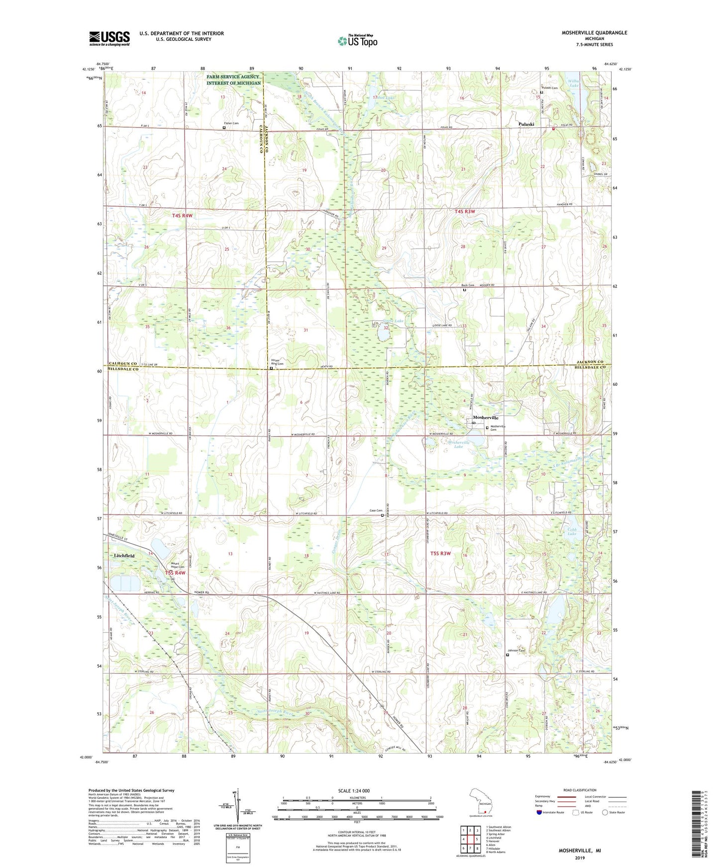
2023 topographic map quadrangle Mosherville in the state of Michigan. Scale: 1:24000. Based on the newly updated USGS 7.5' US Topo map series, this map is in the following counties: Hillsdale, Jackson, Calhoun. The map contains contour data, water features, and other items you are used to seeing on USGS maps, but also has updated roads and other features. This is the next generation of topographic maps. Printed on high-quality waterproof paper with UV fade-resistant inks.
Quads adjacent to this one:
West: Litchfield
Northwest: Southwest Albion
North: Southeast Albion
Northeast: Spring Arbor
East: Hanover
Southeast: North Adams
South: Hillsdale
Southwest: Allen
This map covers the same area as the classic USGS quad with code o42084a6.
Contains the following named places: Beaver Creek, Buck Cemetery, Case Cemetery, Cobb Lake, Conger Drain, Countryside Bible Church, Dresserville School, Fisher Cemetery, Fisher School, Goose Lake, Hastings Lake, Hiram King Cemetery, Hodges School, Johnson Cemetery, Johnson School, King School, Mason School, Mosherville, Mosherville Cemetery, Mosherville Church Historical Marker, Mosherville Lake, Mosherville Post Office, Mosherville School Historical Marker, Mosherville Station, Mount Hope Cemetery, Mud Lake, Proper School, Pulaski, Pulaski Cemetery, Pulaski Free Methodist Church, Pulaski Post Office, Pulaski Station, Pulaski Township Fire Department, Township of Pulaski, Township of Scipio, Twin Pine Campground, Wilbur Lake, Wildwood Acres Campground, ZIP Code: 49250