MyTopo
Mott Island Michigan US Topo Map
Couldn't load pickup availability
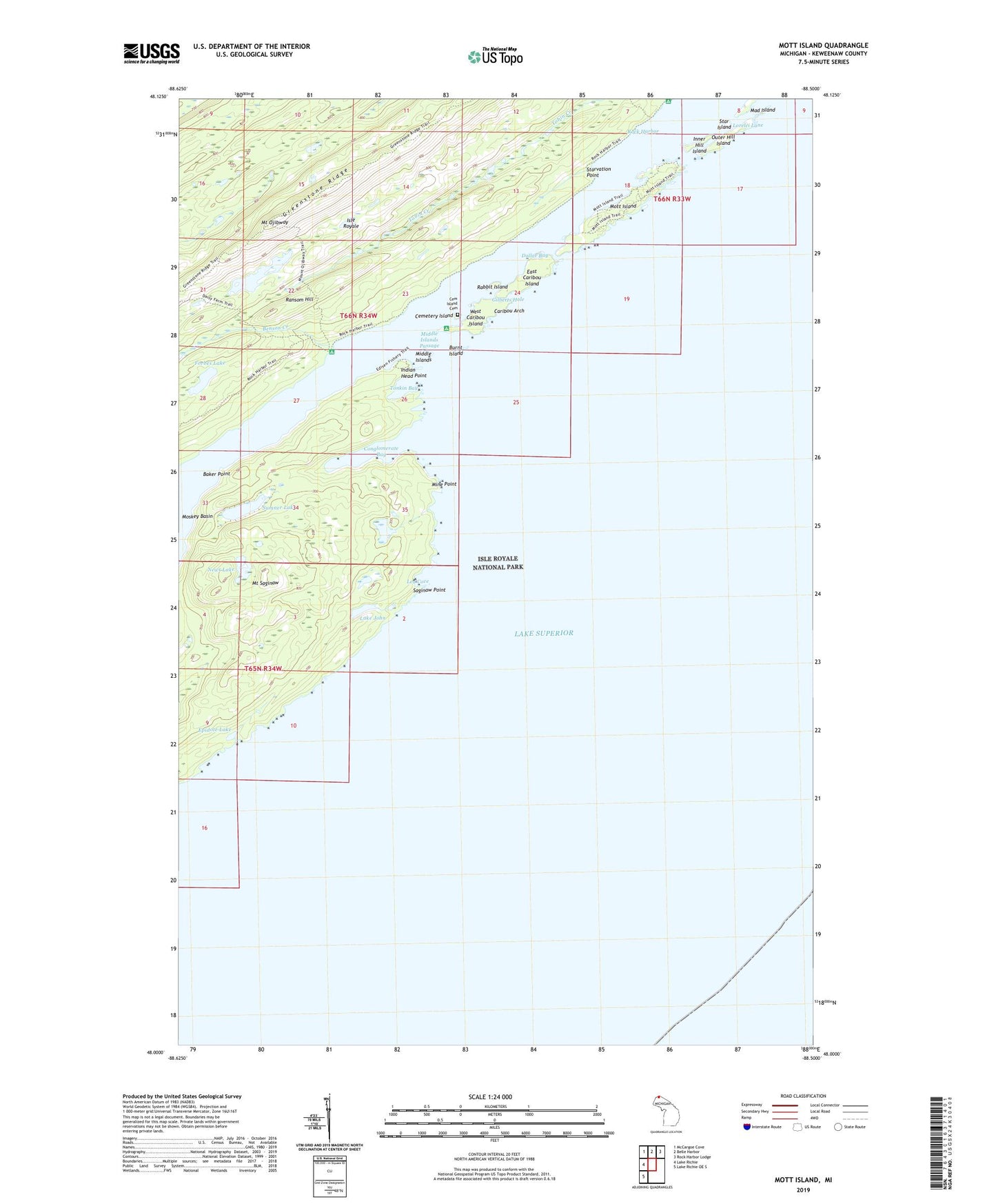
2019 topographic map quadrangle Mott Island in the state of Michigan. Scale: 1:24000. Based on the newly updated USGS 7.5' US Topo map series, this map is in the following counties: Keweenaw. The map contains contour data, water features, and other items you are used to seeing on USGS maps, but also has updated roads and other features. This is the next generation of topographic maps. Printed on high-quality waterproof paper with UV fade-resistant inks.
Quads adjacent to this one:
West: Lake Richie
Northwest: McCargoe Cove
North: Belle Harbor
Northeast: Rock Harbor Lodge
Southwest: Lake Richie OE S
Contains the following named places: Baker Point, Benson Creek, Boreal Research Station, Burnt Island, Caribou Arch, Caribou Island Campground, Cemetery Island, Cemetery Island Cemetery, Conglomerate Bay, Daisy Farm Campground, Daisy Farm Trail, Davidson Island, Dollar Bay, East Caribou Island, Epidote Lake, Epidote Mine, Forbes Lake, Gilberts Hole, Indian Head Point, Inner Hill Island, Lake John, Lake Ojibway, Lea Cove, Lorelei Lane, Lucky Bay Mine, Mad Island, Middle Islands, Middle Islands Passage, Mine Point, Mott Island, Mount Ojibway, Mount Ojibway Trail, Mount Saginaw, Newt Lake, Outer Hill Island, Rabbit Island, Ransom Hill, Ransom Mine, Rock Harbor, Rock Harbor Lighthouse, Rock Harbor Trail, Saginaw Mine, Saginaw Point, Siskowit Mine, Star Island, Starvation Point, Sumner Lake, Threemile Campground, Tonkin Bay, Township of Houghton, West Caribou Island