MyTopo
Belle Harbor Michigan US Topo Map
Couldn't load pickup availability
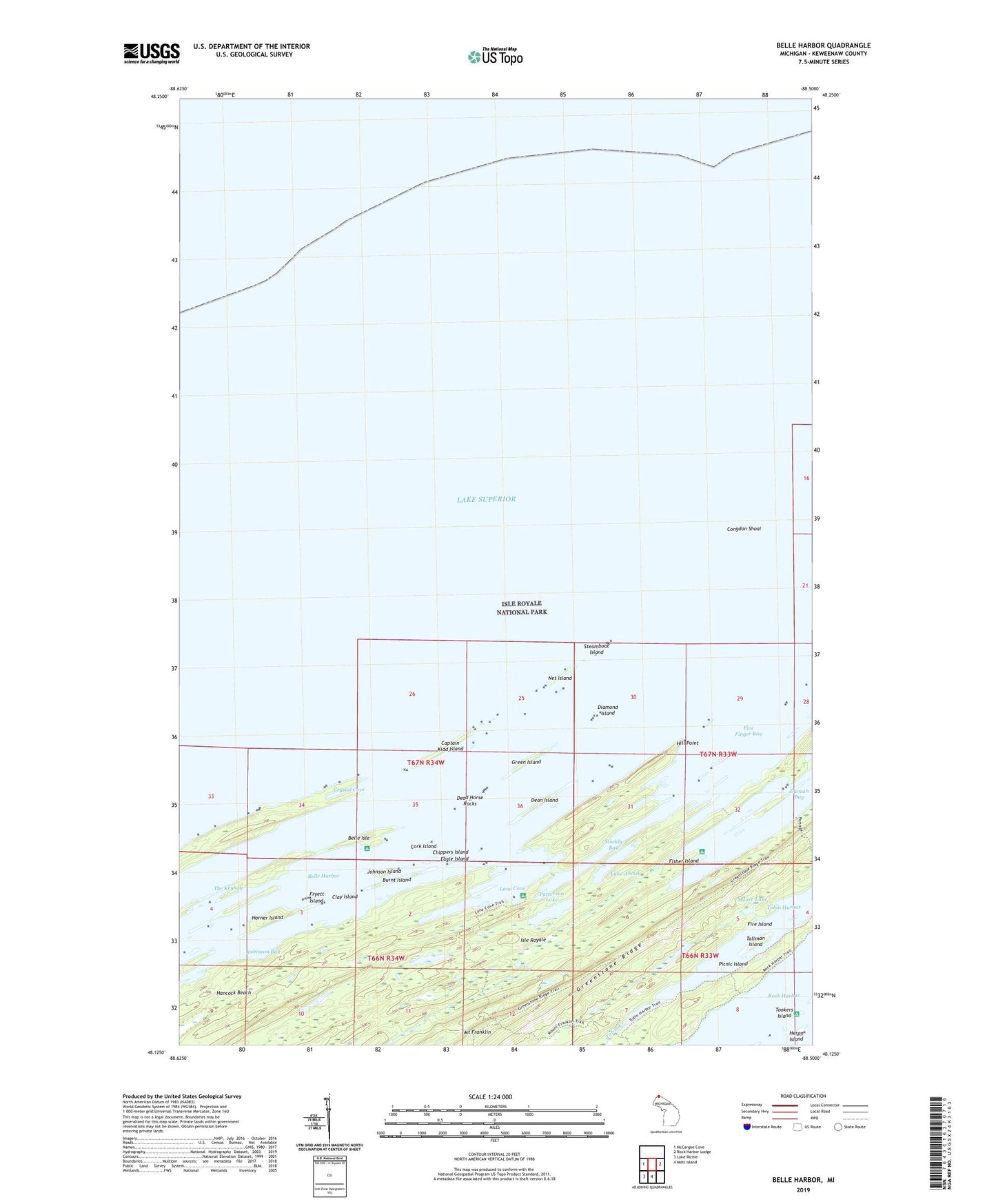
2023 topographic map quadrangle Belle Harbor in the state of Michigan. Scale: 1:24000. Based on the newly updated USGS 7.5' US Topo map series, this map is in the following counties: Keweenaw. The map contains contour data, water features, and other items you are used to seeing on USGS maps, but also has updated roads and other features. This is the next generation of topographic maps. Printed on high-quality waterproof paper with UV fade-resistant inks.
Quads adjacent to this one:
West: McCargoe Cove
East: Rock Harbor Lodge
South: Mott Island
Southwest: Lake Richie
This map covers the same area as the classic USGS quad with code o48088b5.
Contains the following named places: Amygdaloid Channel, Amygdaloid Island, Belle Harbor, Belle Isle, Belle Isle Campground, Burnt Island, Captain Kidd Island, Chippers Island, Clay Island, Congdon Shoal, Cork Island, Crystal Cove, Dead Horse Rocks, Dean Island, Diamond Island, Duncan Bay, Duncan Bay Campground, Eagle Island, Fire Island, Fisher Island, Five Finger Bay, Fryett Island, Green Island, Hancock Beach, Heron Island, Hill Point, Horner Island, Johnson Island, Lake Ahmik, Lane Cove, Lane Cove Campground, Lane Cove Trail, Lauren Grove Park, Moose Lake, Mount Franklin, Mount Franklin Trail, Net Island, Patterson Lake, Picnic Island, Robinson Bay, Steamboat Island, Stockly Bay, Tallman Island, The Keyhole, Tobin Creek, Tobin Harbor Trail, Tookers Island, Tookers Island Campground