MyTopo
Rock Harbor Lodge Michigan US Topo Map
Couldn't load pickup availability
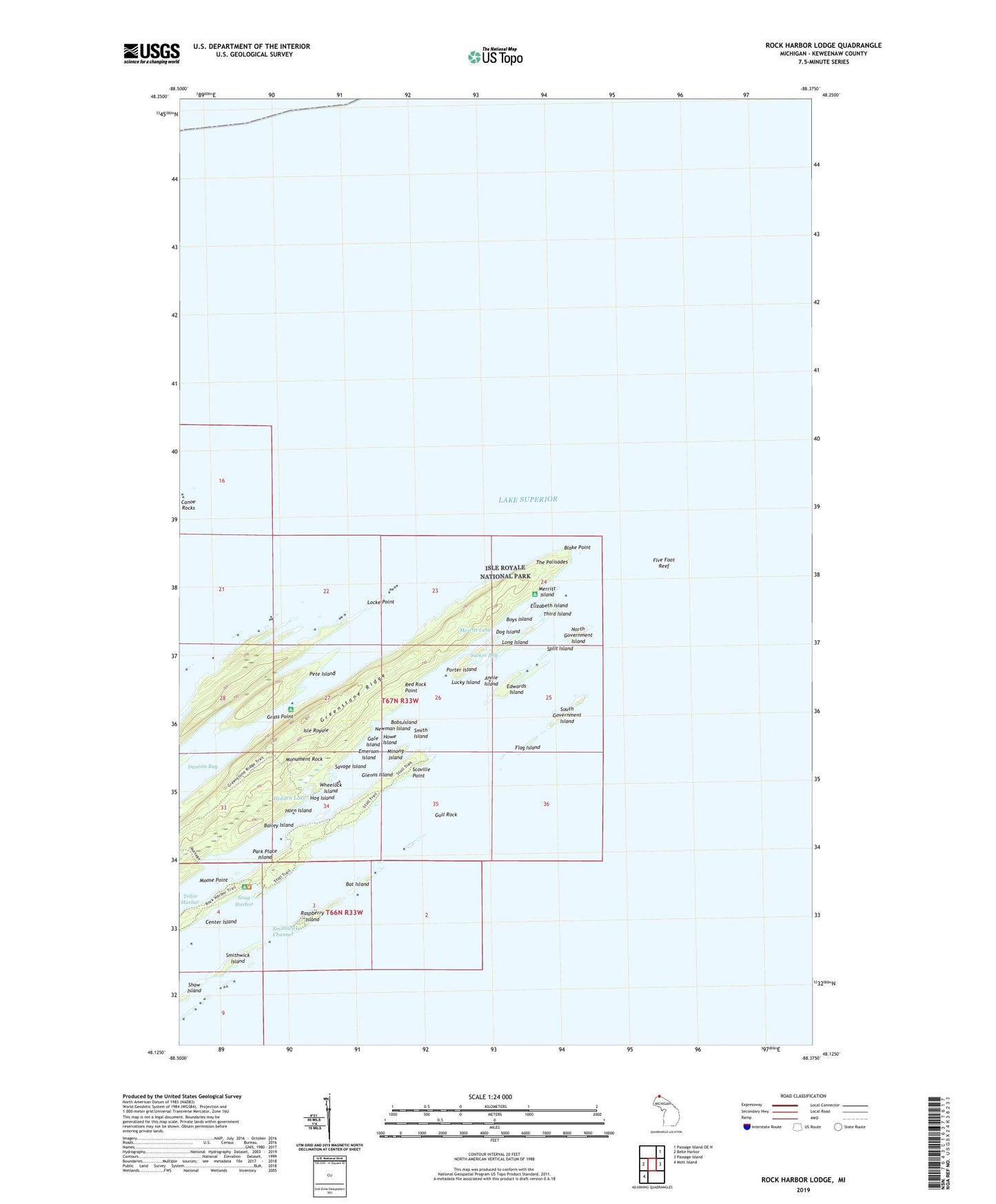
2023 topographic map quadrangle Rock Harbor Lodge in the state of Michigan. Scale: 1:24000. Based on the newly updated USGS 7.5' US Topo map series, this map is in the following counties: Keweenaw. The map contains contour data, water features, and other items you are used to seeing on USGS maps, but also has updated roads and other features. This is the next generation of topographic maps. Printed on high-quality waterproof paper with UV fade-resistant inks.
Quads adjacent to this one:
West: Belle Harbor
Northeast: Passage Island OE N
East: Passage Island
Southwest: Mott Island
This map covers the same area as the classic USGS quad with code o48088b4.
Contains the following named places: Annie Island, Bailey Island, Bat Island, Battleship Island, Blake Point, Bobs Island, Boys Island, Canoe Rocks, Center Island, Daybeacon Stoll Memorial, Dog Island, Duncan Bay Narrows Campground, Edwards Island, Elizabeth Island, Emerson Island, Five Foot Reef, Flag Island, Gale Island, Glenns Island, Grass Point, Gull Rock, Hidden Lake, Hog Island, Horn Island, Howe Island, Locke Point, Lone Tree Island, Long Island, Lookout Louise, Lucky Island, Merritt Island, Merritt Lane, Merritt Lane Campground, Minong Island, Monument Rock, Moose Point, Newman Island, North Government Island, Park Place Island, Pete Island, Porter Island, Raspberry Island, Red Rock Point, Rock Harbor Lodge, Rock Harbor Post Office, Savage Island, Scoville Point, Shaw Island, Smith Island, Smithwick Channel, Smithwick Island, Smithwick Mine, Snug Harbor, South Government Island, Split Island, Stoll Trail, Sucker Bay, The Palisades, Third Island, Tobin Harbor, Tobin-Rock Harbor Campground, Wheelock Island