
MyTopo
Negaunee SW Michigan US Topo Map
Couldn't load pickup availability
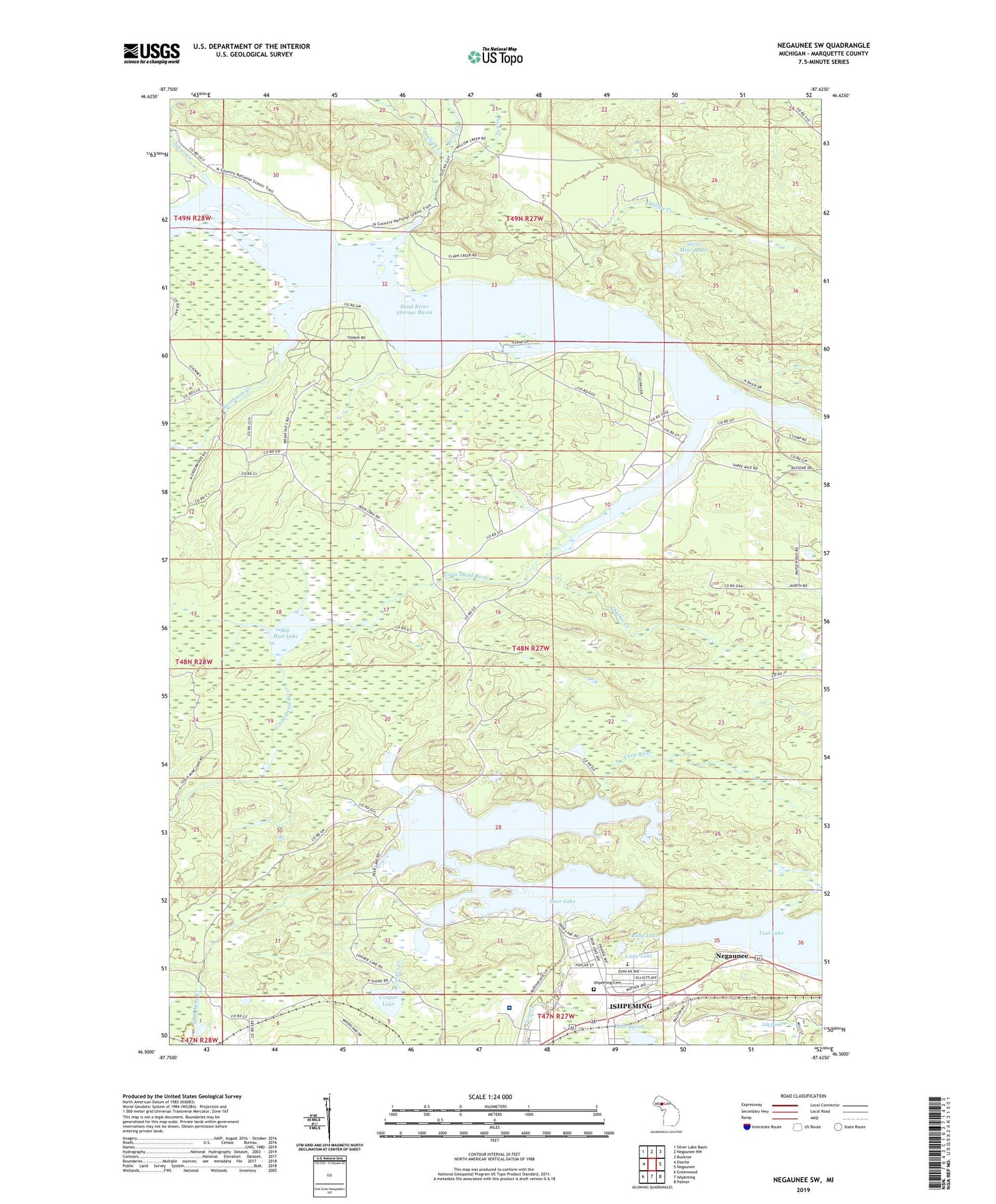
2019 topographic map quadrangle Negaunee SW in the state of Michigan. Scale: 1:24000. Based on the newly updated USGS 7.5' US Topo map series, this map is in the following counties: Marquette. The map contains contour data, water features, and other items you are used to seeing on USGS maps, but also has updated roads and other features. This is the next generation of topographic maps. Printed on high-quality waterproof paper with UV fade-resistant inks.
Quads adjacent to this one:
West: Diorite
Northwest: Silver Lake Basin
North: Negaunee NW
Northeast: Buckroe
East: Negaunee
Southeast: Palmer
South: Ishpeming
Southwest: Greenwood
Contains the following named places: Al Quaal Recreation Area, Baby Lake, Barnhardt Creek, Bethany Lutheran Church, Big Mud Lake, Birchview Elementary School, Boise Creek, Cambria-Jackson Mine, Carp Creek, Clark Creek, Cooper Creek, Cooper Lake, Country Village RV Park, Dead River Storage Basin, Deer Creek, Deer Lake, Gold Mine Creek, Ishpeming Cemetery, Ishpeming: Historic Ski Center Historical Marker, Lake Bacon, Lily Pond, Little Dead River, Little Lake, Lloyd Mine, Mather Mine A, Morris Mine, Mother Baseball Diamond, Saint Joseph Church, Silver Creek, Silver Mine Lakes, Teal Lake, Teal Lake Medical Center, Temple Beth Sholom, UPHS Bell Hospital, Wesley United Methodist Church, Willow Creek, WJPD-AM (Ishpeming), Zhulkie Creek


