MyTopo
Ishpeming Michigan US Topo Map
Couldn't load pickup availability
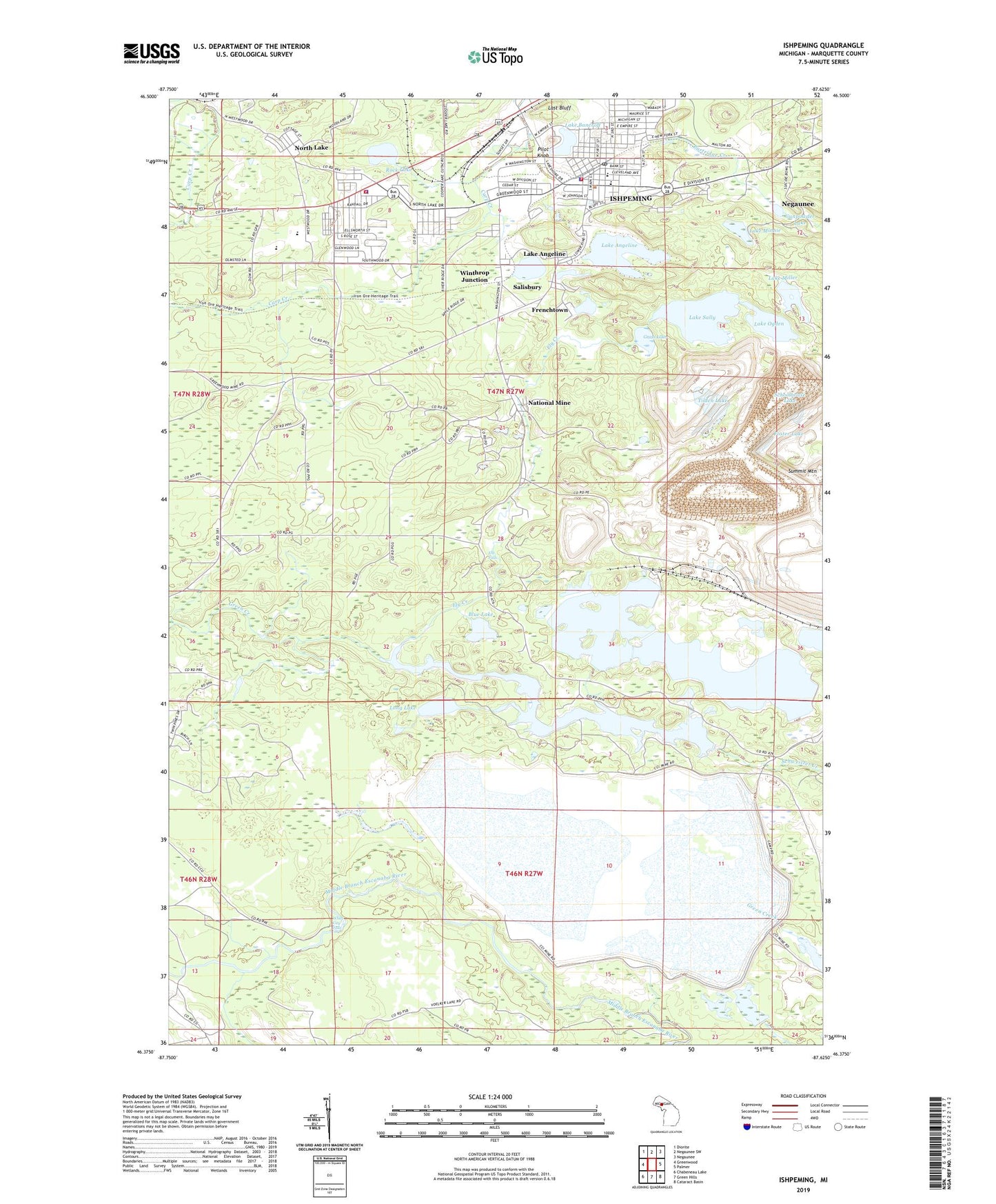
2023 topographic map quadrangle Ishpeming in the state of Michigan. Scale: 1:24000. Based on the newly updated USGS 7.5' US Topo map series, this map is in the following counties: Marquette. The map contains contour data, water features, and other items you are used to seeing on USGS maps, but also has updated roads and other features. This is the next generation of topographic maps. Printed on high-quality waterproof paper with UV fade-resistant inks.
Quads adjacent to this one:
West: Greenwood
Northwest: Diorite
North: Negaunee SW
Northeast: Negaunee
East: Palmer
Southeast: Cataract Basin
South: Green Hills
Southwest: Chabeneau Lake
This map covers the same area as the classic USGS quad with code o46087d6.
Contains the following named places: Apostolic Lutheran Church, Aspen Ridge School, Bethel Lutheran Church, Bible Baptist Church, Blue Lake, Central Elementary School, Christ the King Lutheran Church, City of Ishpeming, Cleveland School, Cliff Lookout Tower, Cliffs Mines, Cliffs Shaft Mine Historical Marker, Cliffs Shaft Mine Museum, Ely Creek, Ely Falls, Faith Lutheran Church, Foster Lake, Frenchtown, Good News Assembly of God Church, Good Shepherd Fellowship, Grace Episcopal Church, Grass Lake, Green Creek, Gunpowder Lake, Hope Free Evangelical Lutheran Church, Ishpeming, Ishpeming City Library, Ishpeming High School, Ishpeming Police Department, Ishpeming Post Office, Ishpeming Station, Ishpeming Township Fire Department, Ishpeming Township Police Department, Ishpeming Township Recreation Area, Ishpeming Volunteer Fire Department, Jasper Knob Scenic Overlook, Jehovah's Witnesses, Laestadian Church, Lake Angeline, Lake Angeline Park, Lake Bancroft, Lake Bancroft Park, Lake Miller, Lake Minnie, Lake Ogden, Lake Sally, Last Bluff, Long Lake, Marquette County Medical Care Facility, Michigan Department of Natural Resources Ishpeming Field Office, National Mine, National Mine Post Office, North Lake, Old Fashion Baptist Church, Partridge Creek, Phelps Middle School, Pilot Knob, Rock Lake, Saint John the Evangelist Church, Salisbury, Salisbury United Methodist Church, Schoolhouse Lake, Stoneville Post Office, Suicide Bowl Ski Jumps, Summit Mountain, Tilden Lake, Tilden Mine, Tilden Post Office, Trinity Lutheran Church, United Evangelical Covenant Church, United Presbyterian Church, West Ishpeming, West Ishpeming Census Designated Place, Westwood High School, White City Falls, Winthrop Junction