MyTopo
Norvell Michigan US Topo Map
Couldn't load pickup availability
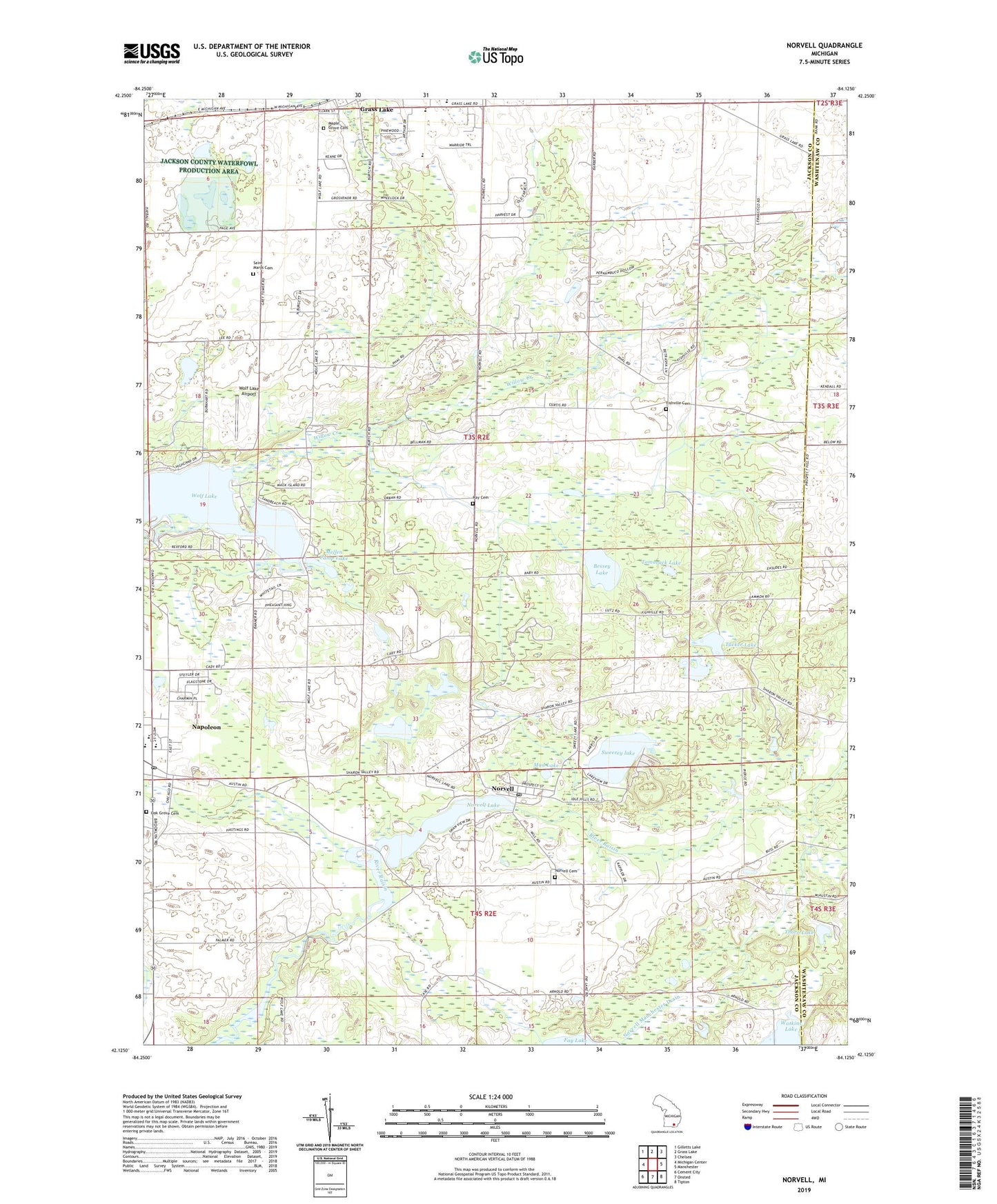
2019 topographic map quadrangle Norvell in the state of Michigan. Scale: 1:24000. Based on the newly updated USGS 7.5' US Topo map series, this map is in the following counties: Jackson, Washtenaw. The map contains contour data, water features, and other items you are used to seeing on USGS maps, but also has updated roads and other features. This is the next generation of topographic maps. Printed on high-quality waterproof paper with UV fade-resistant inks.
Quads adjacent to this one:
West: Michigan Center
Northwest: Gilletts Lake
North: Grass Lake
Northeast: Chelsea
East: Manchester
Southeast: Tipton
South: Onsted
Southwest: Cement City
Contains the following named places: Apple Creek Resort and RV Park, Bessey Lake, Charter Township of Grass Lake, Close School, Cobb Lake, Coppernoll School, Dorr School, Eby Elementary School, First Baptist Church, Fishville, Fishville Cemetery, Fishville School, Grass Lake High School, Grey Tower, Jackson County Park, Jackson County Waterfowl Production Area, Jude Stone Quarry, Little Wolf Lake, Long School, Maple Grove Cemetery, Mellen Camp Lake, Mud Lake, Napolean Post Office, Napoleon, Napoleon Census Designated Place, Napoleon High School, Napoleon Middle School, Napoleon Station, Napoleon United Methodist Church, Norvell, Norvell Cemetery, Norvell Community Baptist Church, Norvell Lake, Norvell Manchester Drain, Norvell Plains School, Norvell Post Office, Norvell Station, Oak Grove Cemetery, Prospect Hill School, Ray Cemetery, Romanian Orthodox Episcopate, Saint Marys Cemetery, Sharonville State Wildlife Management Area, Sweezey lake, Tamarack Lake, Thorn Lake, Township of Norvell, Tucker Lake, Twin Knolls Golf Course, Willow Creek, Wolf Lake, Wolf Lake Airport, ZIP Codes: 49261, 49263