MyTopo
Ossineke Michigan US Topo Map
Couldn't load pickup availability
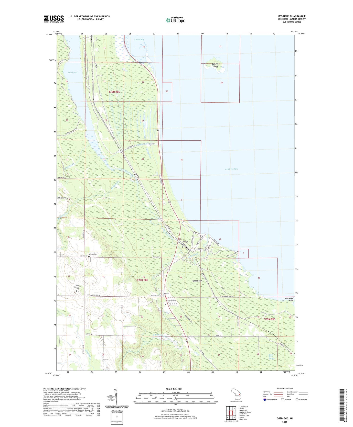
2019 topographic map quadrangle Ossineke in the state of Michigan. Scale: 1:24000. Based on the newly updated USGS 7.5' US Topo map series, this map is in the following counties: Alpena. The map contains contour data, water features, and other items you are used to seeing on USGS maps, but also has updated roads and other features. This is the next generation of topographic maps. Printed on high-quality waterproof paper with UV fade-resistant inks.
Quads adjacent to this one:
West: Big Ravine Creek
Northwest: Lake Winyah
North: Alpena
Northeast: North Point
East: South Point
Southeast: Black River
South: Spruce
Southwest: Hubbard Lake
Contains the following named places: Alcona Health Center, Berlinski Creek, Cranberry Creek, Devils Lake, Devils River, German Cemetery, Good Shepherd Lutheran Church, Hardwood Point, North Branch Devils River, Northland Baptist Church, Ossineke, Ossineke Census Designated Place, Ossineke Forest Campground, Ossineke Park, Ossineke Post Office, Ossineke Station, Ossineke United Methodist Church, Precore Creek, Riverview Estates Mobile Home Park, Saint Catherine Church, Saint Catherine's Cemetery, Sanborn Country Park, Sanborn School, Sanborn Township Cemetery, Sanborn Township Fire Department, South Branch Devils River, Sulphur Island, Township of Sanborn, ZIP Code: 49766