MyTopo
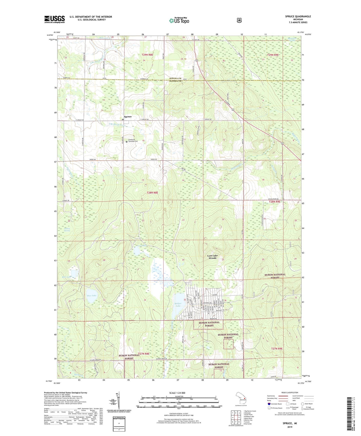
Spruce Michigan US Topo Map
Couldn't load pickup availability
Also explore the Spruce Forest Service Topo of this same quad for updated USFS data
2023 topographic map quadrangle Spruce in the state of Michigan. Scale: 1:24000. Based on the newly updated USGS 7.5' US Topo map series, this map is in the following counties: Alcona, Alpena. The map contains contour data, water features, and other items you are used to seeing on USGS maps, but also has updated roads and other features. This is the next generation of topographic maps. Printed on high-quality waterproof paper with UV fade-resistant inks.
Quads adjacent to this one:
West: Hubbard Lake
Northwest: Big Ravine Creek
North: Ossineke
Northeast: South Point
East: Black River
Southeast: Harrisville
South: Lincoln
Southwest: Barton City
This map covers the same area as the classic USGS quad with code o44083g4.
Contains the following named places: Badger Lake, Bear Lake, Black River Swamp, Caledonia Township Cemetery, Caledonia Township Hall, Deer Lake, Holcomb Creek, Kingdom Hall of Jehovah's Witnesses, Liston Creek, Lost Lake, Lost Lake Woods, Lost Lake Woods Census Designated Place, Lost Lake Woods Golf Club, Ludwig Swamp, Monarch Ridge Golf Course, Paul Bunyan Kampground, Ritchie Post Office, Spruce, Spruce Lutheran Church, Spruce Post Office, Spruce Presbyterian Church, Township of Alcona, ZIP Code: 48762