MyTopo
Lake Winyah Michigan US Topo Map
Couldn't load pickup availability
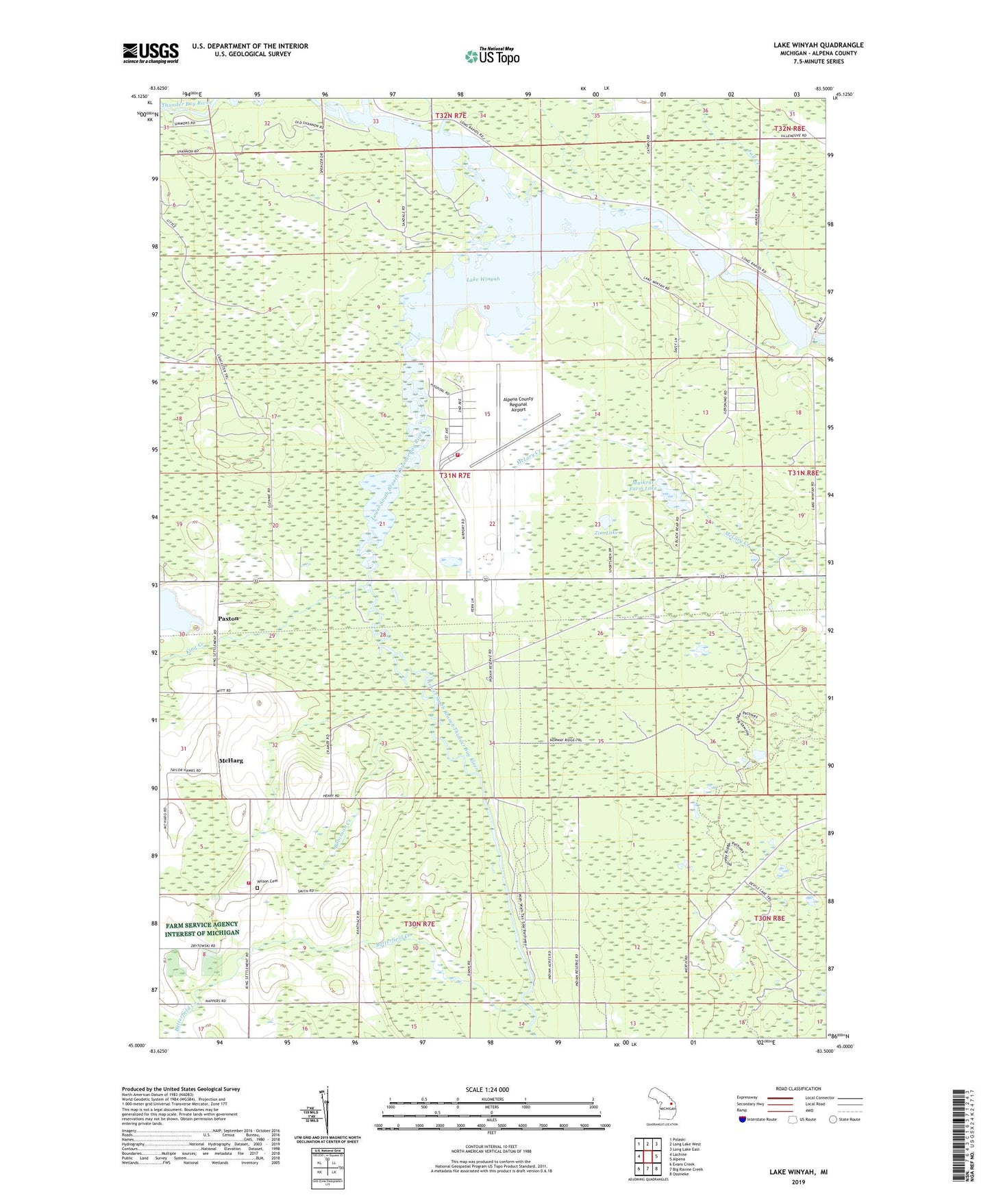
2023 topographic map quadrangle Lake Winyah in the state of Michigan. Scale: 1:24000. Based on the newly updated USGS 7.5' US Topo map series, this map is in the following counties: Alpena. The map contains contour data, water features, and other items you are used to seeing on USGS maps, but also has updated roads and other features. This is the next generation of topographic maps. Printed on high-quality waterproof paper with UV fade-resistant inks.
Quads adjacent to this one:
West: Lachine
Northwest: Polaski
North: Long Lake West
Northeast: Long Lake East
East: Alpena
Southeast: Ossineke
South: Big Ravine Creek
Southwest: Evans Creek
This map covers the same area as the classic USGS quad with code o45083a5.
Contains the following named places: Alpena Army Air Field, Alpena Combat Readiness Training Center Fire and Rescue Services, Alpena County Regional Airport, Butterfield Creek, Campers Grove Campground, Devils Lake Trail, Fall Creek, Fourmile Dam, Fourmile Pond, Huron Shores Fellowship Church, Kerston Station, King Creek, Kingsbury Creek, Lake Winyah, Lower South Branch Thunder Bay River, McHarg, Michigan Department of Natural Resources Alpena Field Office, Muskrat Farm Lake, North Branch Thunder Bay River, Norway Point Dam, Norway Ridge Trail, Paxton, Robinson Creek, Thunder Bay River State Forest Campground, Township of Wilson, Wilson Cemetery, Wilson Township Fire and Rescue, Woodland Camp, Zim Lake