MyTopo
Payment Michigan US Topo Map
Couldn't load pickup availability
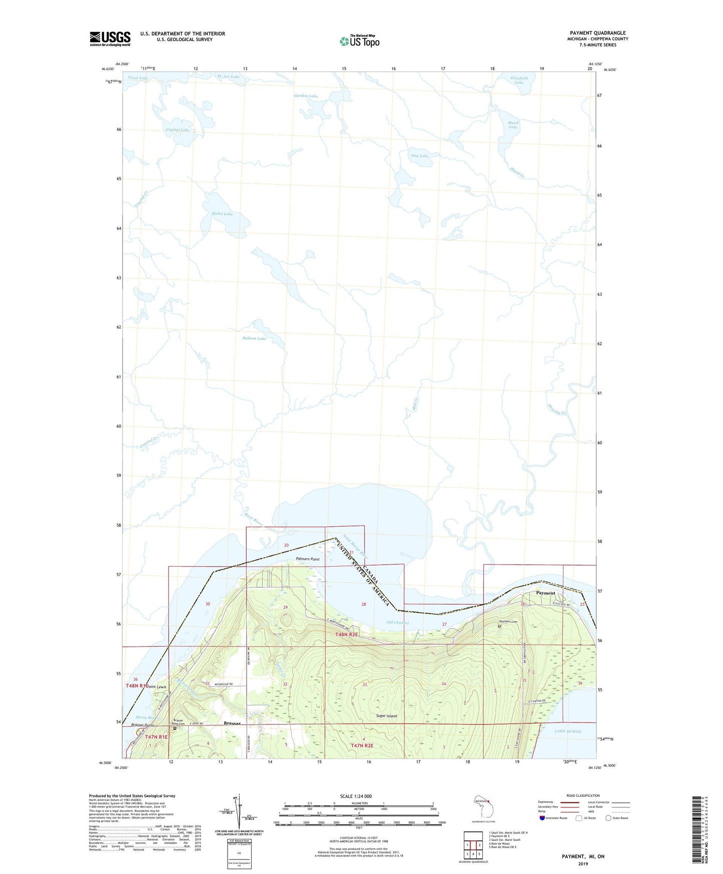
2023 topographic map quadrangle Payment in the state of Michigan. Scale: 1:24000. Based on the newly updated USGS 7.5' US Topo map series, this map is in the following counties: Chippewa. The map contains contour data, water features, and other items you are used to seeing on USGS maps, but also has updated roads and other features. This is the next generation of topographic maps. Printed on high-quality waterproof paper with UV fade-resistant inks.
Quads adjacent to this one:
East: Payment OE E
Southeast: Baie de Wasai OE E
South: Baie de Wasai
This map covers the same area as the classic USGS quad with code o46084e2.
Contains the following named places: Brassar, Brassar Point, Brassar Post Office, Brasser Road Cemetery, Holy Angel Church, Masta Bay, McFarland Creek, Old Channel, Palmers Point, Payment, Payment Cemetery, Payment Post Office, Point Lewis, Sucker Creek