MyTopo
Posen Michigan US Topo Map
Couldn't load pickup availability
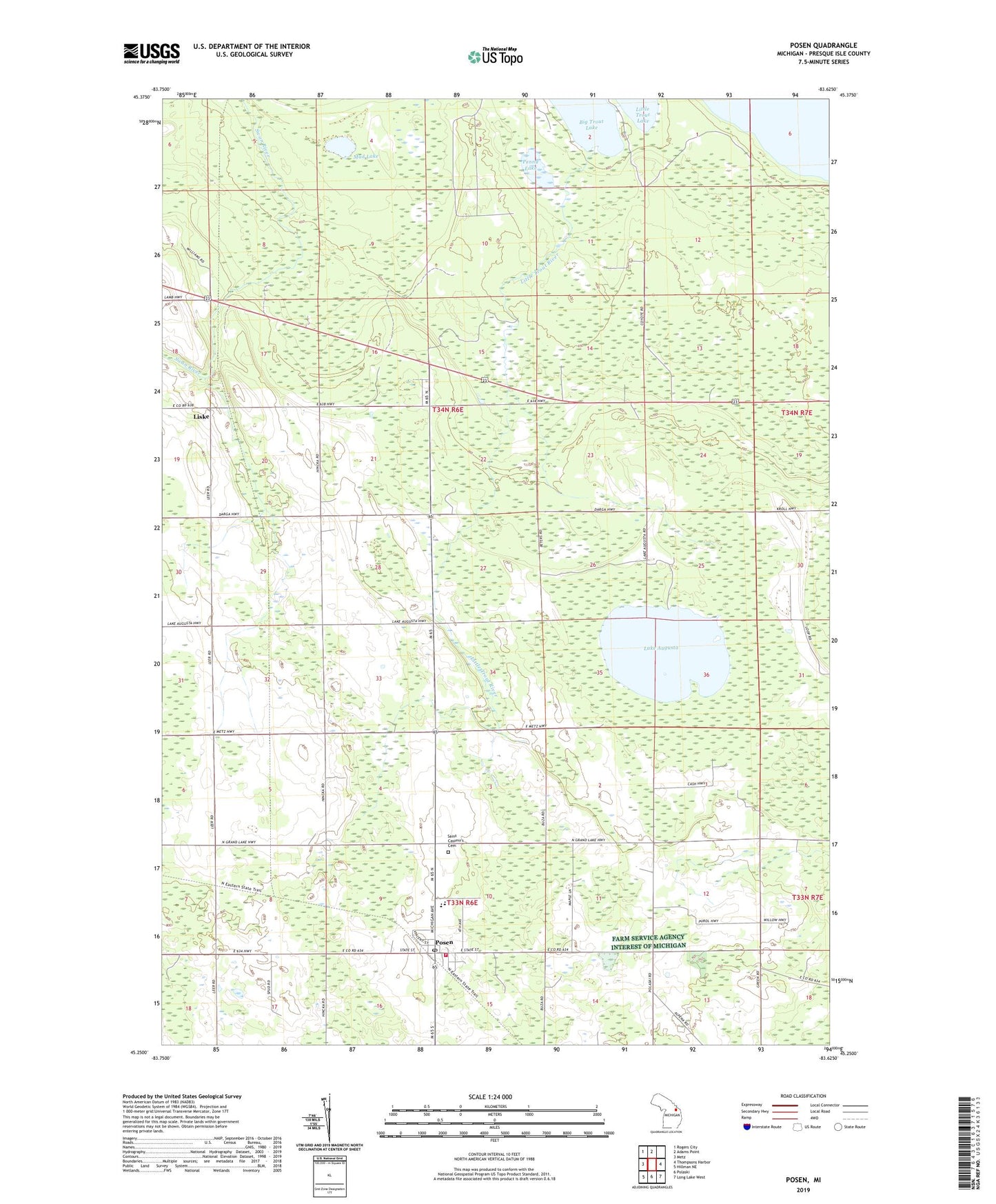
2019 topographic map quadrangle Posen in the state of Michigan. Scale: 1:24000. Based on the newly updated USGS 7.5' US Topo map series, this map is in the following counties: Presque Isle. The map contains contour data, water features, and other items you are used to seeing on USGS maps, but also has updated roads and other features. This is the next generation of topographic maps. Printed on high-quality waterproof paper with UV fade-resistant inks.
Quads adjacent to this one:
West: Metz
Northwest: Rogers City
North: Adams Point
East: Thompsons Harbor
Southeast: Long Lake West
South: Polaski
Southwest: Hillman NE
Contains the following named places: Big Trout Lake, Lake Augusta, Liske, Little Trout River, Mud Lake, Orchard, Orchard Station, Penny Lake, Posen, Posen Area Fire and Rescue, Posen Consolidated School, Posen Post Office, Posen Station, Presque Isle District Library, Presque Isle Electic Cooperative Monument Historical Marker, Saint Casimir School, Saint Casimir's Cemetery, Township of Pulawski, Village of Posen