MyTopo
Metz Michigan US Topo Map
Couldn't load pickup availability
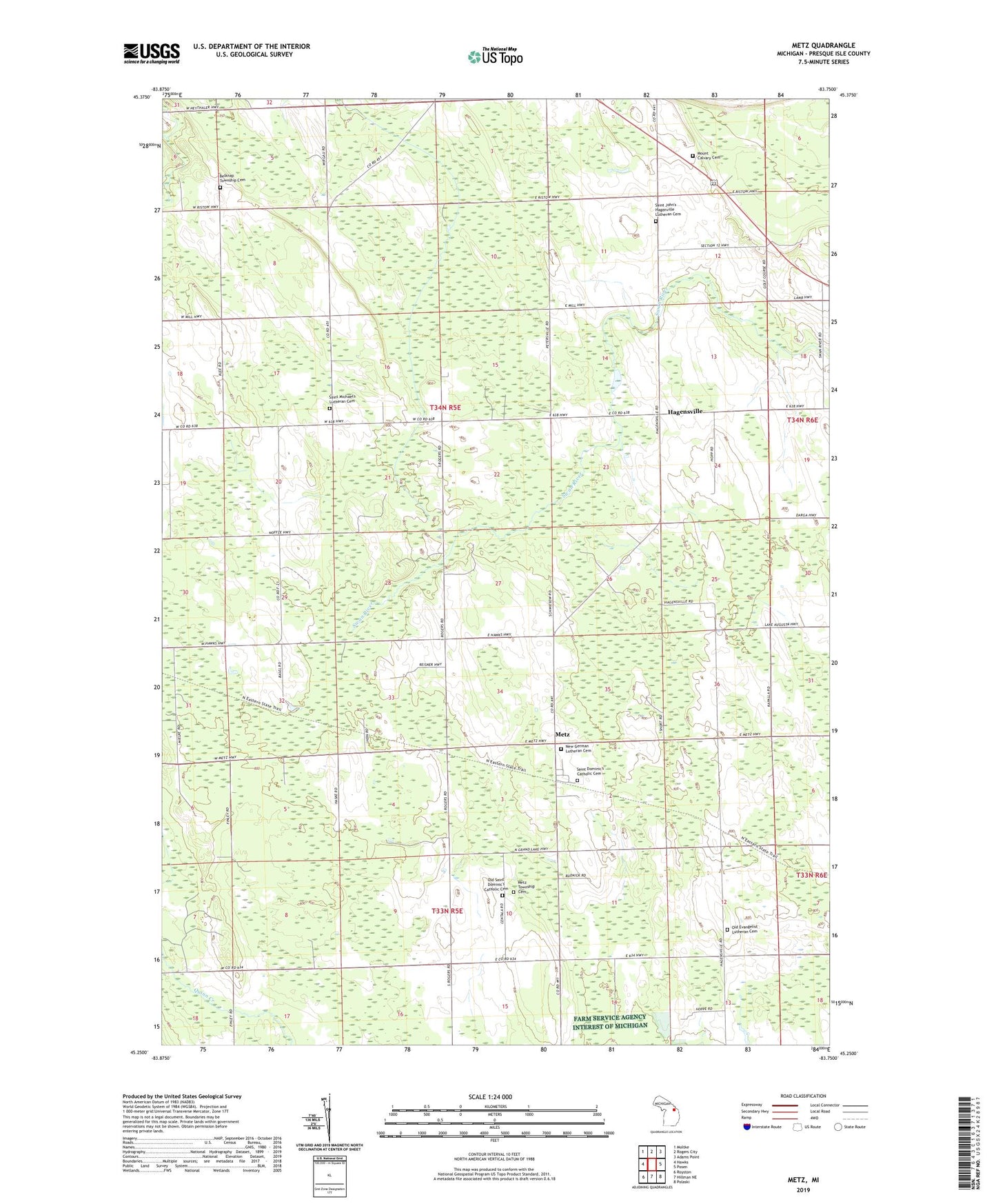
2023 topographic map quadrangle Metz in the state of Michigan. Scale: 1:24000. Based on the newly updated USGS 7.5' US Topo map series, this map is in the following counties: Presque Isle. The map contains contour data, water features, and other items you are used to seeing on USGS maps, but also has updated roads and other features. This is the next generation of topographic maps. Printed on high-quality waterproof paper with UV fade-resistant inks.
Quads adjacent to this one:
West: Hawks
Northwest: Moltke
North: Rogers City
Northeast: Adams Point
East: Posen
Southeast: Polaski
South: Hillman NE
Southwest: Royston
This map covers the same area as the classic USGS quad with code o45083c7.
Contains the following named places: Belknap, Belknap Township Cemetery, Hagensville, Hagensville Post Office, Metz, Metz Post Office, Metz Station, Metz Township Cemetery, Mount Calvary Cemetery, Nagel Post Office, New German Lutheran Cemetery, Old Evangelist Lutheran Cemetery, Old Saint Dominic's Catholic Cemetery, Rogers City Country Club, Saint Dominic's Catholic Cemetery, Saint Johns Church, Saint John's Hagenville Lutheran Cemetery, Saint Michael's Lutheran Cemetery, Saint Michael's Lutheran Church, Saint Michael's Lutheran School, Saint Peter Lutheran Church, South Rogers Station, Southrogers Post Office, The Metz Fire Historical Marker, Township of Belknap, WMLQ-FM (Rogers City)