MyTopo
Polaski Michigan US Topo Map
Couldn't load pickup availability
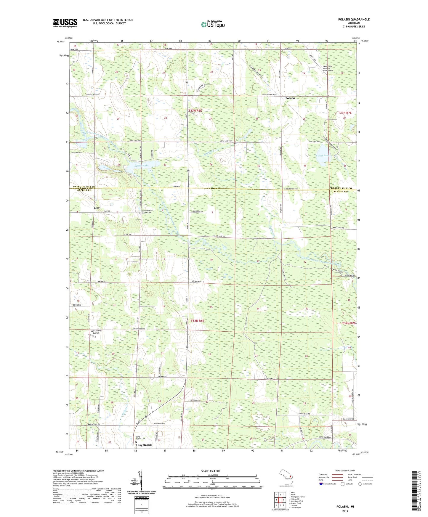
2023 topographic map quadrangle Polaski in the state of Michigan. Scale: 1:24000. Based on the newly updated USGS 7.5' US Topo map series, this map is in the following counties: Alpena, Presque Isle. The map contains contour data, water features, and other items you are used to seeing on USGS maps, but also has updated roads and other features. This is the next generation of topographic maps. Printed on high-quality waterproof paper with UV fade-resistant inks.
Quads adjacent to this one:
West: Hillman NE
Northwest: Metz
North: Posen
Northeast: Thompsons Harbor
East: Long Lake West
Southeast: Lake Winyah
South: Lachine
Southwest: Jewett Creek
This map covers the same area as the classic USGS quad with code o45083b6.
Contains the following named places: Cub Landing Center, Duck Lake, Elowsky Dam, Elowsky Mill Historical Marker, Erskine Creek, Fletcher Park, Grace Church, Leer, Leer Church, Leer Lutheran Church Cemetery, Leer Post Office, Long Rapids, Long Rapids Cemetery, Long Rapids Congregational Church, Long Rapids Post Office, Orchard Hill Post Office, Polaski, Polaski Station, Saint Pauls Church, Saint Paul's Lutheran Church Cemetery, Sobieski Post Office, Sunken Lake, Sunken Lake Park, Township of Long Rapids, Township of Posen, ZIP Code: 49776