MyTopo
Presque Isle Michigan US Topo Map
Couldn't load pickup availability
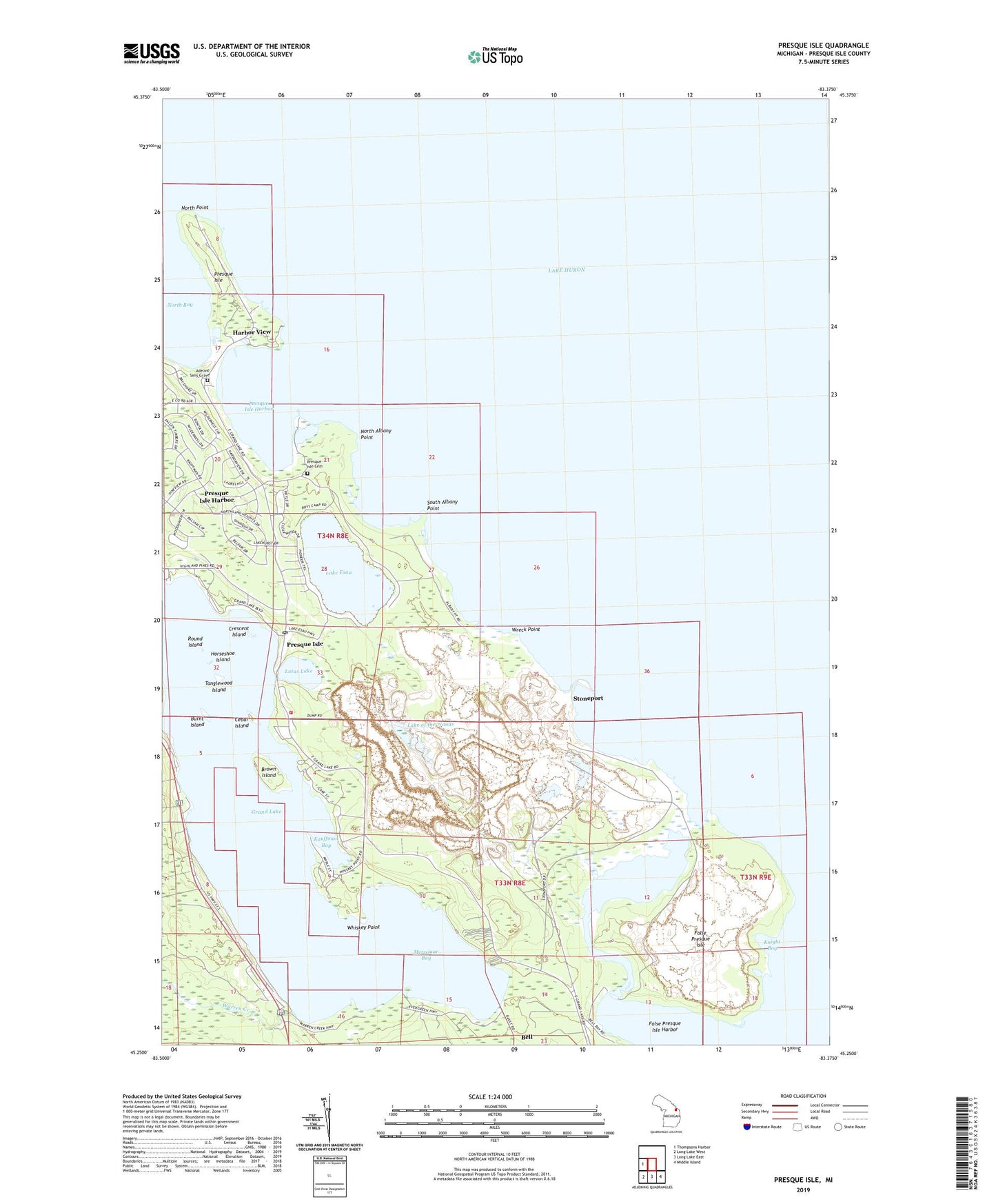
2023 topographic map quadrangle Presque Isle in the state of Michigan. Scale: 1:24000. Based on the newly updated USGS 7.5' US Topo map series, this map is in the following counties: Presque Isle. The map contains contour data, water features, and other items you are used to seeing on USGS maps, but also has updated roads and other features. This is the next generation of topographic maps. Printed on high-quality waterproof paper with UV fade-resistant inks.
Quads adjacent to this one:
West: Thompsons Harbor
Southeast: Middle Island
South: Long Lake East
Southwest: Long Lake West
This map covers the same area as the classic USGS quad with code o45083c4.
Contains the following named places: Adeline Sims Grave, Bell River, Brown Island, Burnt Island, Camp Chickagami, Cedar Island, Crescent Island, East Grand Lake Fire Department, False Presque Isle, False Presque Isle Harbor, Grand Lake Branch Library, Grand Lake Community Chapel, Harbor View, Horseshoe Island, Kauffman Bay, Knight Bay, Lake Esau, Lake of the Woods, Larks Harbor Lodge, Lotus Lake, Metzelaar Bay, North Albany Point, North Point, Old Lighthouse, Old Presque Isle Lighthouse, Old Presque Isle Lighthouse Historical Marker, Preque Isle Light, Presque Isle, Presque Isle Cemetery, Presque Isle Corporation, Presque Isle Harbor, Presque Isle Harbor Census Designated Place, Presque Isle Light Station Historical Marker, Presque Isle Lighthouse, Presque Isle Post Office, Presque Isle Rear Range Lighthouse, Presque Isle Township Museum, Round Island, South Albany Point, Stoneport, Stoneport Quarry, Tanglewood Island, Township of Presque Isle, Warren Creek, Whiskey Point, Wreck Point