MyTopo
Schoolcraft Michigan US Topo Map
Couldn't load pickup availability
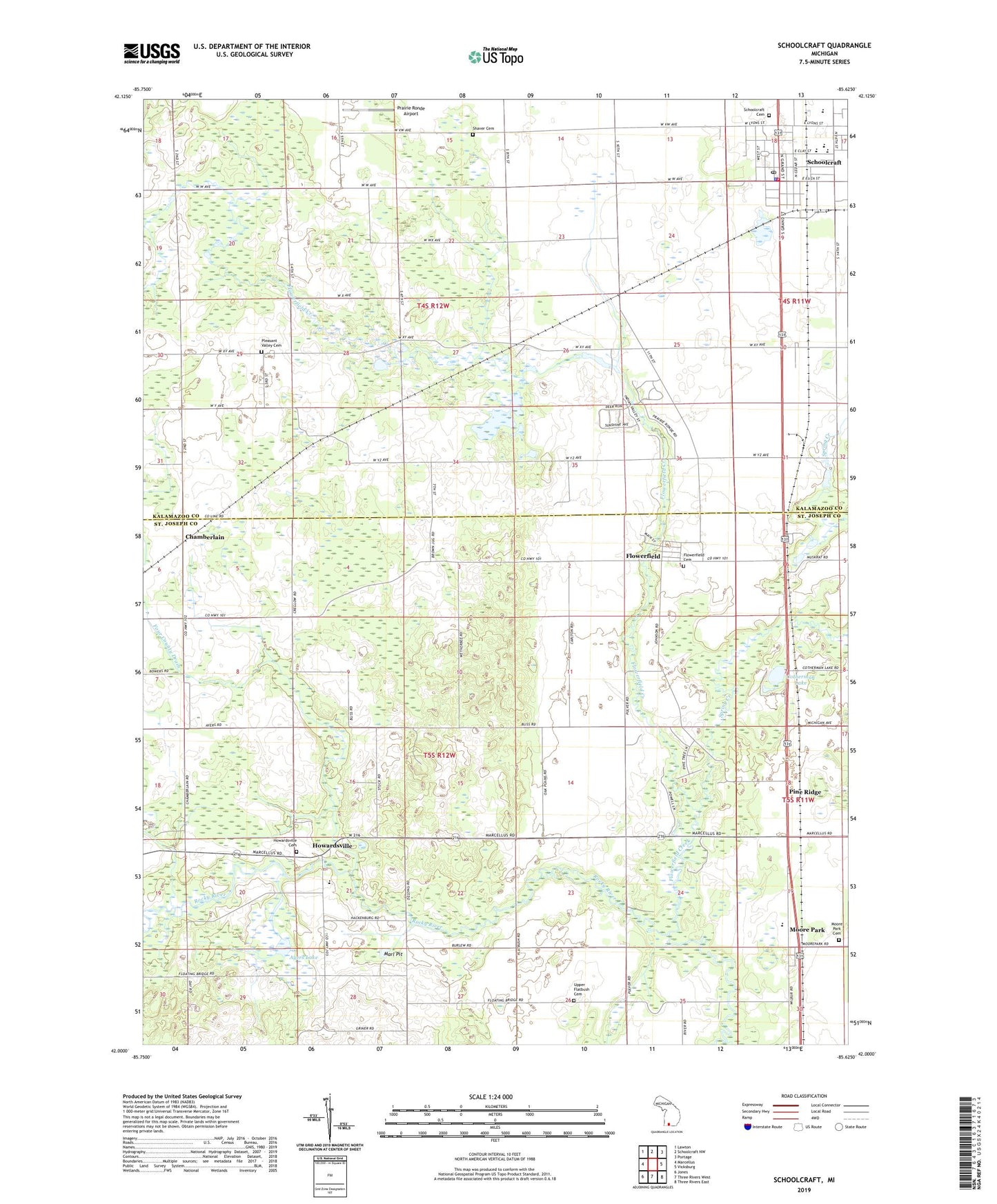
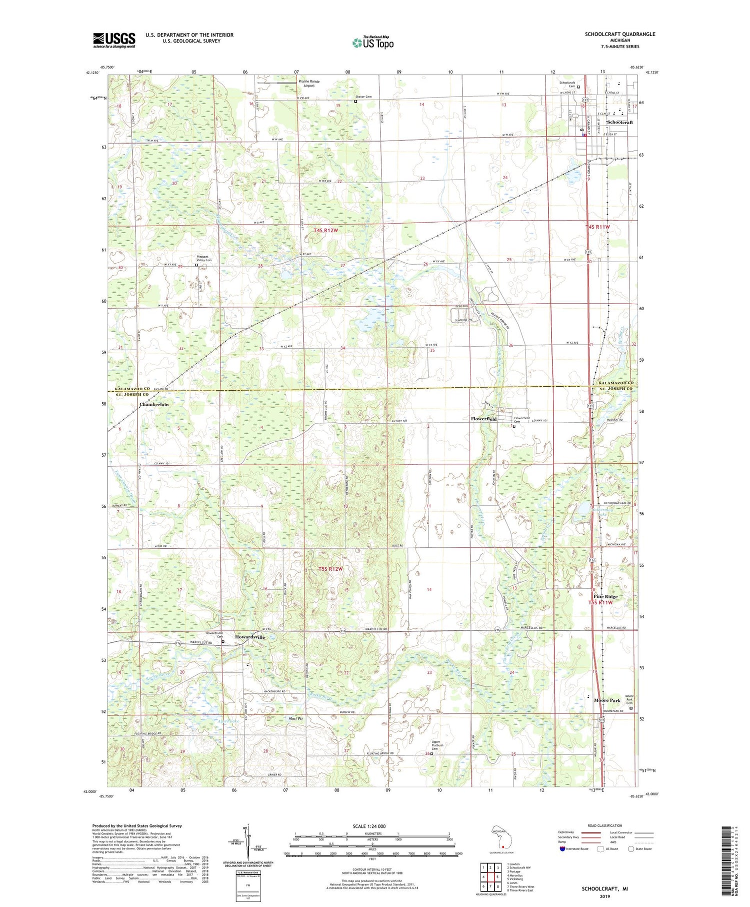
2019 topographic map quadrangle Schoolcraft in the state of Michigan. Scale: 1:24000. Based on the newly updated USGS 7.5' US Topo map series, this map is in the following counties: St. Joseph, Kalamazoo. The map contains contour data, water features, and other items you are used to seeing on USGS maps, but also has updated roads and other features. This is the next generation of topographic maps. Printed on high-quality waterproof paper with UV fade-resistant inks.
Quads adjacent to this one:
West: Marcellus
Northwest: Lawton
North: Schoolcraft NW
Northeast: Portage
East: Vicksburg
Southeast: Three Rivers East
South: Three Rivers West
Southwest: Jones
Contains the following named places: Ayers Lake, Chamberlain, Cotherman Lake, Edwards Corners, Edwards Corners Bible Church, Flowerfield, Flowerfield Cemetery, Flowerfield Creek, Flowerfield Post Office, Four County Drain, Howardsville, Howardsville Cemetery, Howardsville Christian School, Howardsville Gospel Chapel, Howardsville Post Office, Leesburg Post Office, Leesburg Station, Marl Pit, Metropolitan Community Church, Moore Park, Moore Park Cemetery, Moorepark Post Office, Moorepark Station, Olde Mill Golf Club, Park Elementary School, Pine Ridge, Pine View Golf Course, Pleasant Valley Cemetery, Pleasant Valley Church, Prairie Ronde Airport, Schoolcraft, Schoolcraft Cemetery, Schoolcraft Community Library, Schoolcraft Elementary School, Schoolcraft Fire Department, Schoolcraft High School, Schoolcraft Police Department, Schoolcraft Post Office, Schoolcraft Station, Schoolcraft United Methodist Church, Shaver Cemetery, South Kalamazoo County Fire Authority Station 1, Spring Creek, Township of Flowerfield, Township of Prairie Ronde, Upper Flatbush Cemetery, Village of Schoolcraft, ZIP Code: 49087