MyTopo
Marcellus Michigan US Topo Map
Couldn't load pickup availability
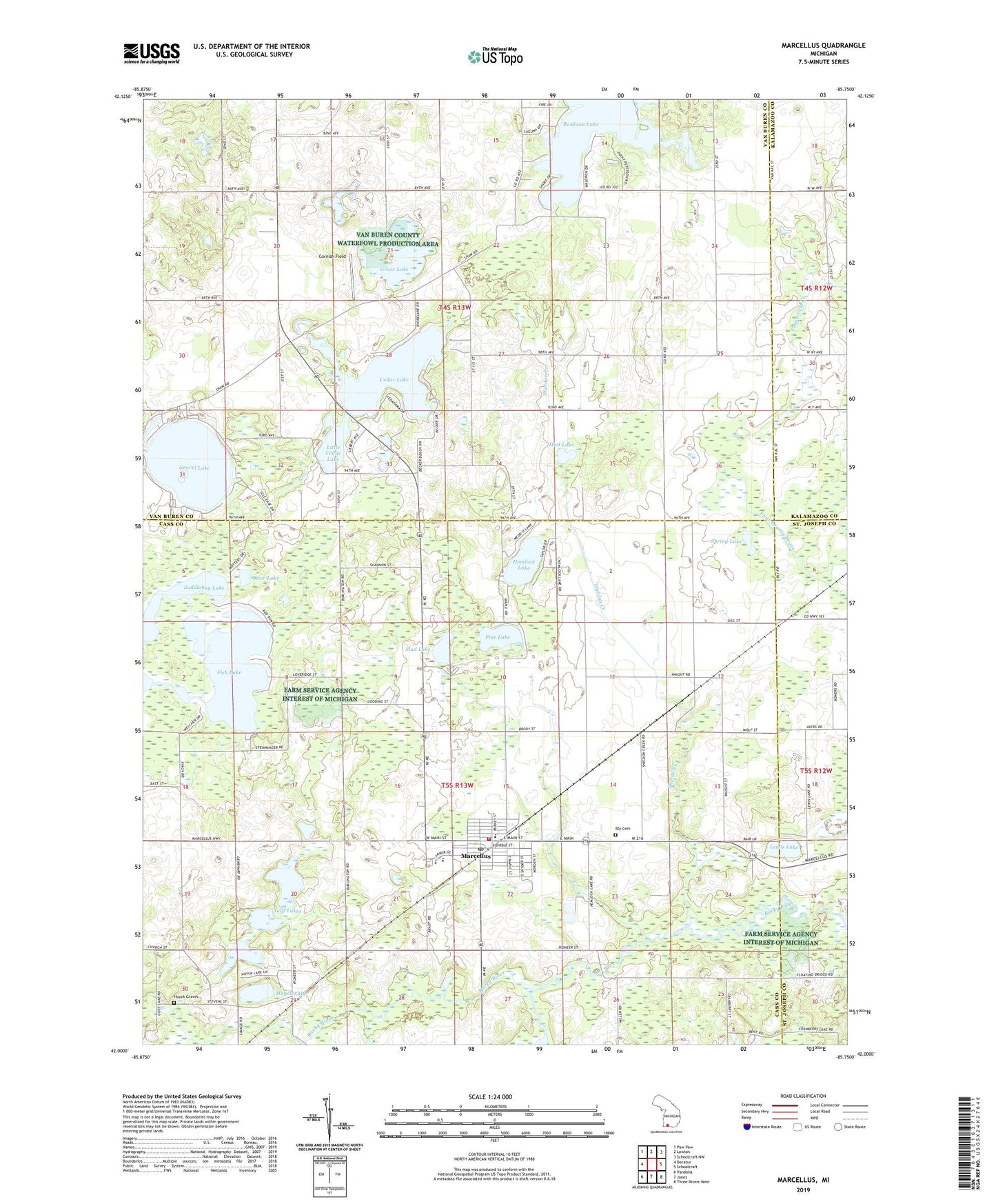
2023 topographic map quadrangle Marcellus in the state of Michigan. Scale: 1:24000. Based on the newly updated USGS 7.5' US Topo map series, this map is in the following counties: Cass, Van Buren, St. Joseph, Kalamazoo. The map contains contour data, water features, and other items you are used to seeing on USGS maps, but also has updated roads and other features. This is the next generation of topographic maps. Printed on high-quality waterproof paper with UV fade-resistant inks.
Quads adjacent to this one:
West: Decatur
Northwest: Paw Paw
North: Lawton
Northeast: Schoolcraft NW
East: Schoolcraft
Southeast: Three Rivers West
South: Jones
Southwest: Vandalia
This map covers the same area as the classic USGS quad with code o42085a7.
Contains the following named places: Adams School, Bankson Lake, Batchelor School, Beech Grove Trailer Park, Bly Cemetery, Bly School, Camp Shawadasee, Cedar Lake, Cornish Field, Cranberry Lake Campground, Globe School, Goff Lake Campgrounds, Goff Lakes, Grass Lake, Gravel Lake, Harmony Chapel, Hemlock Lake, Hemlock Lake Campground, Huyck Graves, Huyck Lake, Kinney School, Lakeview Family Care, Lewis Lake, Little Cedar Lake, Marcellus, Marcellus Elementary School, Marcellus Fire Department - Ambulance Service, Marcellus High School, Marcellus Middle School, Marcellus Police Department, Marcellus Post Office, Marcellus Station, Marcellus Township Library, Maxam School, Melville Landing Strip, Mud Lake, Otter Lake, Patrick School, Peacock Ridge Golf Course, Pickerel Lake, Pine Lake, Porter Center School, Porter Church, Porter Town Hall, Saddlebag Lake, Saint Margaret Mary Church, Shannon School, Sheldon Creek, Sheldon School, Spring Lake, Township of Marcellus, Township of Porter, Trinity Bible Church, United Methodist Church, Van Buren County Waterfowl Production Area, Village of Marcellus, ZIP Code: 49067